Overview
The Lower Sonoran Trail is relatively new (it was completed in 2016) in the Fountain Hills McDowell Mountain Preserve (FHP). Hikers can do a loop hike in the northern end of the FHP by combining the Lower Sonoran Trail and the Sonoran Trail on a hike.
Hike
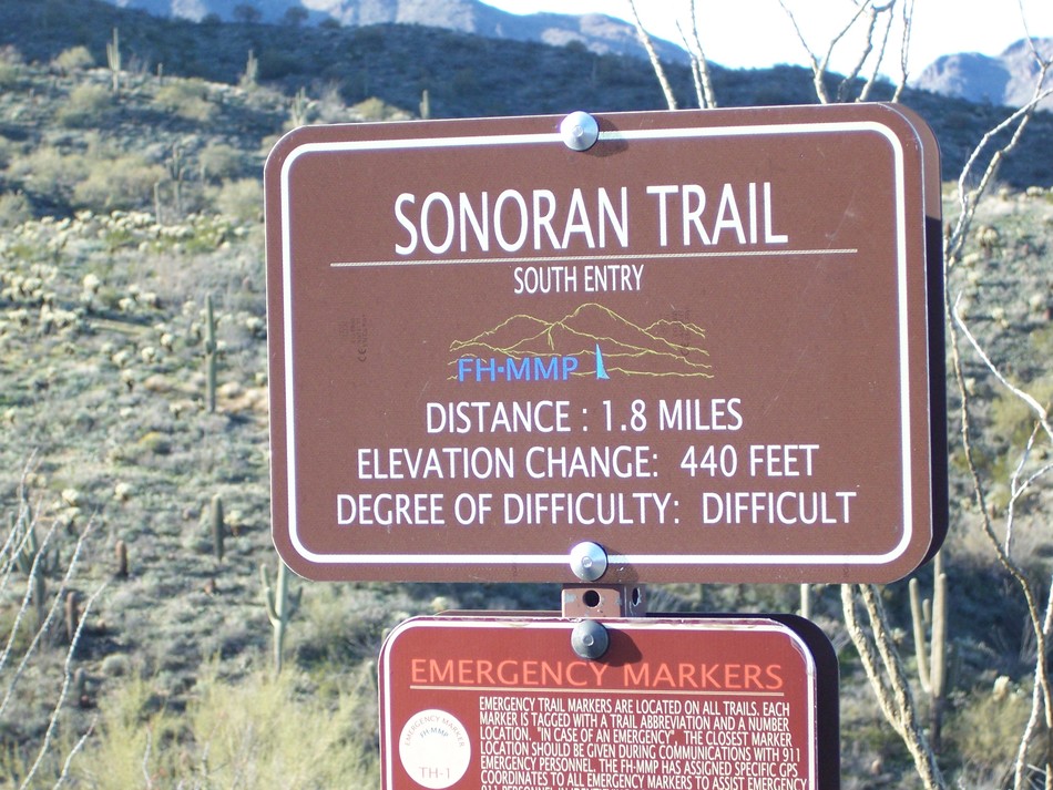
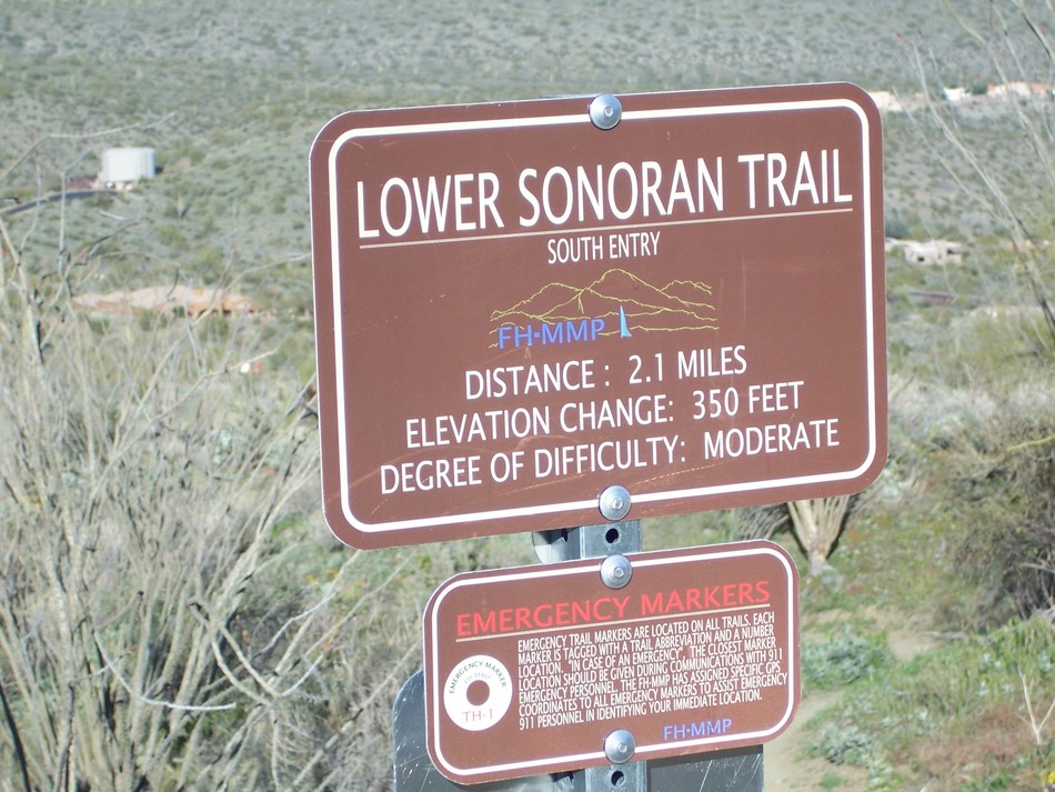
The Lower Sonoran Trail is best accessed from the Adero Canyon Trailhead. From the trailhead, take the Promenade Trail north until its terminus at a junction where the Sonoran Trail goes to the left and the Lower Sonoran Trail goes to the right. At the junction you will see two signs: one for the Sonoran Trail and one for the Lower Sonoran Trail.
The Lower Sonoran Trail goes for 2 miles, at which point it converges with the Sonoran Trail at the boundary between the FHP and the Maricopa County McDowell Mountain Regional Preserve (MMRP). At that point you have 3 options: 1) Turn around and go back the way you came to the Promenade Trail, 2) make a loop by taking the Sonoran Trail back to the Promenade Trail, or 3) go north on the Sonoran Trail into the MMRP -- you'll hike about 0.8 miles until you come to the Dixie Mine Trail.
The Lower Sonoran Trail is almost all dirt with very little rock, so it is easy to hike on. The trail goes through typical Sonoran Desert vegetation, and there are nice views to the east of Four Peaks, the Mazatzal Mountains, the Goldfield Mountains, and the Superstition Mountains.
When hiking several trails on a single "hike", log it with a generic name that describes the hike. Then link the trails traveled, check out the example.
WARNING! Hiking and outdoor related sports can be dangerous. Be responsible and prepare for the trip. Study the area you are entering and plan accordingly. Dress for the current and unexpected weather changes. Take plenty of water. Never go alone. Make an itinerary with your plan(s), route(s), destination(s) and expected return time. Give your itinerary to trusted family and/or friends.
Permit $$
None
Directions
Road
Paved - Car Okay
To Adero Canyon Trailhead From Loop 101 and Shea Blvd head east on Shea Blvd for 7.8 miles. Then turn left on N Palisades Blvd and continue 1.1 miles. Turn left at the stop sign onto Eagle Ridge Drive and continue 2.4 miles until you reach the Adero Canyon Trailhead. Note that along the way Eagle Ridge Drive first becomes N 143rd Way and then becomes N Eagle Ridge Drive.
• February 2019: There is road construction on Eagle Ridge Dr, and the last mile to the trailhead is on a well-graded, unpaved road. However, that section of the road will ultimately be paved.
• January 2020 FHP writes: Fountain Hills (Parks & Wildlife Dept..480-816-5100): Adero Cyn TH/Parking is presently "only" accessible for parking access at the closed chain link fence ~1 mile "prior-to" TH Parking on N. Eagle Ridge Drive. M-F Trailhead access from ~1 mile up road is only legal from 3pm daily. Sat & Sun TH access from ~1 mile up road is legal from dawn to dusk.
• 2020-02-15 Yoder writes: Road to trailhead parking is closed due to construction. You may want to go to the Sunrise Trailhead parking. • 2020-11-09 Grasshopper writes: Officially opened, and the road to the Parking / TH is now paved.
From PHX (I-10 & AZ-51) 43 min (32.3 miles) From TUC (Jct 1-10 & Grant) 2 h 7 min (131 miles) From FLG (Jct I-17 & I-40) 2 h 28 min (155 miles)
 Route Editor

 Overview
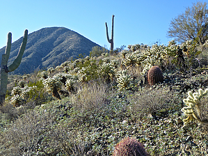


