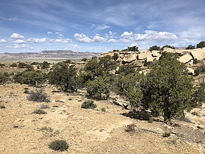
The entire hike is a bushwhack with the exception of an occasional cow path. There is not enough visitation to have created a footpath.
Your immediate mission is to find a way over the barbed wire fence. I found a spot with a boulder on each side which made for an easy crossing. Follow the cow path up out of the drainage and head east. Aiming for the right side of the knoll in front of you is a good idea. Your going to pass thru three small canyons, each progressively larger to gain your prize. Keep heading east basically heading for the middle of each subsequent canyon ridge summit. When you get to the third canyon aim for the slick rock drainage in the middle of the ridge in front of you.
Follow the slick rock as it splits the ridge. Once you get to the top, follow the cliff on your left to the rock art just slightly above your head in clear view. When finished return the way you came. You may be tempted to take one of the canyons south thinking it will take you to the road for a quicker return. Not a good idea, you'll get cliffed out.
WARNING! Hiking and outdoor related sports can be dangerous. Be responsible and prepare for the trip. Study the area you are entering and plan accordingly. Dress for the current and unexpected weather changes. Take plenty of water. Never go alone. Make an itinerary with your plan(s), route(s), destination(s) and expected return time. Give your itinerary to trusted family and/or friends.
Permit $$
None
Directions
Road
Paved - Car Okay
To hike From I-70 take exit 116 and head towards the town of Moore on the Moore Cutoff Road. At miles 5.5 park anywhere on the shoulder of the road. This is your trailhead.
 Route Editor