Route Editor

| Guide | ♦ | 1 Triplog | 0 Topics |
details | drive | no permit | forecast | map |
stats |
photos | triplog | topics | location |
| 11 | 1 | 0 |
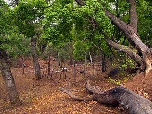
An excellent source of omega-3 by HAZ_Hikebot  This trail begins on the east side of Pinal Point and heads east down scenic Cave Creek and Sardine Creek canyons to the Sardine Falls area. Formerly known as Cave Creek Trail #10. Backpacking opportunities exist. As of June 2009, the west end of the trail is in great shape and is easy to follow. This trail begins on the east side of Pinal Point and heads east down scenic Cave Creek and Sardine Creek canyons to the Sardine Falls area. Formerly known as Cave Creek Trail #10. Backpacking opportunities exist. As of June 2009, the west end of the trail is in great shape and is easy to follow.Check out the Triplog. Note This is a more difficult hike. It would be unwise to attempt this without prior experience hiking. Leave No Trace and +Add a Triplog after your hike to support this local community. | |||||||||||||||||||||||||||||||||||||||||||||||||||||||||||||||||||||