 Route Editor

| Guide | ♦ | 5 Triplogs | 0 Topics |
details | drive | permit | forecast | route |
stats |
photos | triplogs | topics | location |
| 0 | 5 | 0 |
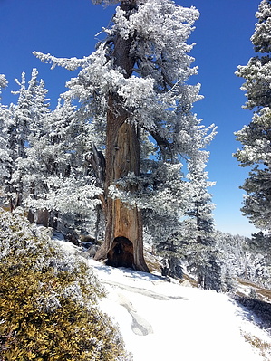
The Trail to the Clouds by DixieFlyer This trail is the last leg up to Mount San Jacinto in the famed Cactus-to-Clouds hike. Hike This trail begins at the Wellman Divide and goes to the summit of Mount San Jacinto (10,834').
This trail is a bit rocky, so it is not the easiest trail to hike on. About 0.3 miles below the Mount San Jacinto summit, the Peak Trail comes to a junction with the Deer Springs Trail. At the junction go right (north) to stay on the Peak Trail. Just below the summit hikers will pass by an emergency shelter, which was built by the CCC in 1933. There is a bit of class 3 rock scrambling in the final 200 feet or so to the summit. There is no exposure on the scramble, so it is not dangerous; however, it is advisable to be careful while scrambling over some medium sized boulders. Check out the Official Route and Triplogs. Leave No Trace and +Add a Triplog after your hike to support this local community. One-Way Notice This hike is listed as One-Way. When hiking several trails on a single "hike", log it with a generic name that describes the hike. Then link the trails traveled, check out the example. | ||||||||||||||||||||||||||||||||||||||||||||||||||||||||||||||||||||||||||||||||||||||||||||||||


