Route Editor

| Guide | ♦ | 1 Triplog | 0 Topics |
details | drive | permit | forecast | map |
stats |
photos | triplog | topics | location |
| 16 | 1 | 0 |
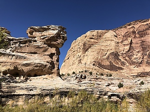
Don’t Drink The Water by AZLOT69 This hike is in a very remote section of the San Rafael Swell. Be prepared for anything. The chances of not seeing anyone else for days is possible. Cell phone service is available at the trailhead but not in the canyon. Hike From the sawbuck fencing at the trailhead take the old atv trail down the hill behind the fence. The trail will enter a no named wash in about a quarter mile. Follow the wash as it meanders. At the half mile point watch for a cairn on your left as the old atv trail reappears and bear left here. Follow the trail to the end, an old camping spot on the cliff edge of Salt Wash. Look for a cairn marking the point of descent into the canyon. The trail is marked fairly well with cairns to the bottom. It’s steep in sections, covered with loose shale and you will need to scramble a bit.
Continuing on the trail becomes quite overgrown with willow trees and salt cedar. You may have to cross the wash several times. The next major swing to the left should have you looking high right for more petroglyphs. It was in this overgrown section of trail we encountered harvester ants on the plants. They are stinging ants so we hightailed it thru this section. The trail swings right and you are on a bench above the wash. It’s much easier hiking here on. Cliffs both sides of the wash. You’ll come to a fence line. This was my turn around point. The trail continues if you’re up to it to the San Rafael River. Check out the Triplog. Leave No Trace and +Add a Triplog after your hike to support this local community. | ||||||||||||||||||||||||||||||||||||||||||||||||||||||||||||||||||||||||||||||||||||||