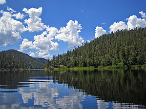
Want to escape the heat and go to a nice isolated area with a short hike, a great lake, and great views? Then Chevelon Lake is the place to go. Off the Mogollon lies great views, many short hikes, and a few lakes to relax at. Perhaps Chevelon Lake is the most isolated Lake in the area as Woods Canyon and Bear Canyon Lakes see more people.
Hiking down to Chevelon Lake is what probably keeps many people away, but it is a nice short and steep hike with a great reward of isolation once down there. The hike is on an old Jeep road that is nice and rocky, watch your step. After a few twists and turns on the road, the canyon will come into view and you know you are about to drop into something special. The lake will then come into view and you make your way right to the shore where you could launch a small boat, that you carried down of course. The shore area away from here is rocky and drop-offs that prevent you from making your way around it unless you are bold. Chevelon Lakes wraps around a few miles so you cannot see the entire lake, but the spot you are in here is worth the short hike down.
There is a dam in place here as well where you could do down and explore some pools and catch craw daddies if you like that sort of thing. Otherwise enjoy the nice cool water at the lake and soak in the views. You will probably only see a few people the entire day and if you like to fish this is one of the best trout lakes in all of Arizona. Otherwise, carry down a tube and float in the water a bit before hiking back up the steep road which will be the only hard part of your day.
WARNING! Hiking and outdoor related sports can be dangerous. Be responsible and prepare for the trip. Study the area you are entering and plan accordingly. Dress for the current and unexpected weather changes. Take plenty of water. Never go alone. Make an itinerary with your plan(s), route(s), destination(s) and expected return time. Give your itinerary to trusted family and/or friends.
Permit $$
None
Directions
Road
FR / Dirt Road / Gravel - Car Okay
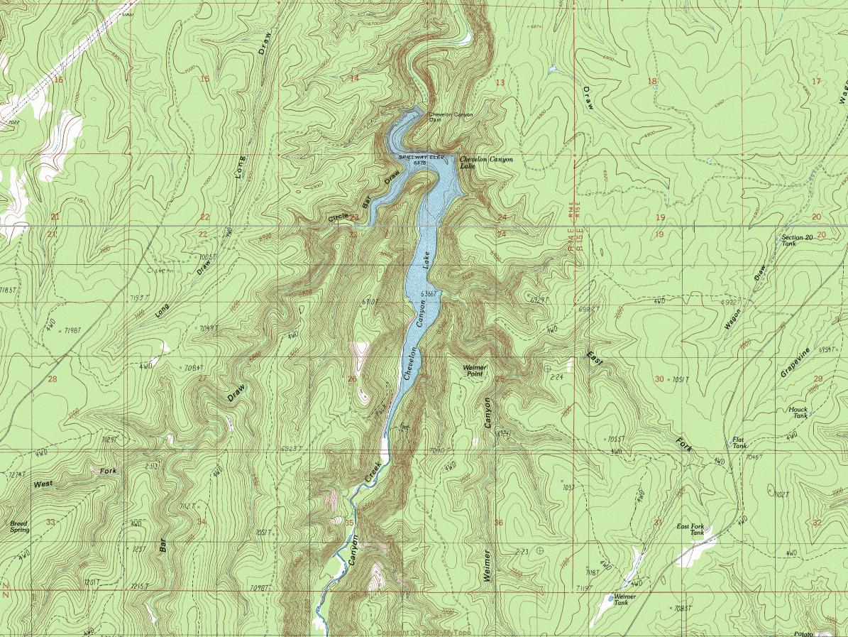
To hike From the Phoenix area, take 87 North to Payson. From Payson take 260 East to Rim Road which is FR 300 and the Woods Canyon turnoff. Make a left and take FR 300 9 miles to FR 169. Turn right on FR 169 and follow for 12 miles to FR 169B. Turn right on FR 169B and follow 3 miles to the campground. Park here and start hiking down to the lake.
page created by desert_boonie on Jul 12 2009 1:10 pm
 Route Editor


 Want to escape the heat and go to a nice isolated area with a short hike, a great lake, and great views? Then Chevelon Lake is the place to go. Off the Mogollon lies great views, many short hikes, and a few lakes to relax at. Perhaps Chevelon Lake is the most isolated Lake in the area as Woods Canyon and Bear Canyon Lakes see more people.