 Route Editor

| Guide | ♦ | 2 Triplogs | 0 Topics |
details | drive | no permit | forecast | 🔥 route |
stats |
photos | triplogs | topics | location |
| 47 | 2 | 0 |
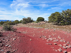
  Remote 8 room Salado Indian ruin site located within the Sierra Ancha Mountains. The ruins are on a scenic ridgeline at Peak 5074 below Mistake Peak. The hike is a short, mildly rugged off-trail route with moderate bushwhack. The surrounding views from the summit, including Picture Mountain and Four Peaks, are excellent. An excellent destination for those with a love for ancient Indian history and off-trail adventure. Remote 8 room Salado Indian ruin site located within the Sierra Ancha Mountains. The ruins are on a scenic ridgeline at Peak 5074 below Mistake Peak. The hike is a short, mildly rugged off-trail route with moderate bushwhack. The surrounding views from the summit, including Picture Mountain and Four Peaks, are excellent. An excellent destination for those with a love for ancient Indian history and off-trail adventure.Check out the Official Route and Triplogs. Leave No Trace and +Add a Triplog after your hike to support this local community. One-Way Notice This hike is listed as One-Way. When hiking several trails on a single "hike", log it with a generic name that describes the hike. Then link the trails traveled, check out the example. | |||||||||||||||||||||||||||||||||||||||||||||||||||||||||||||||||||||||||||||||||||||||||||


