| Guide | ♦ | 2 Triplogs | 0 Topics |
details | drive | no permit | forecast | 🔥 route |
stats |
photos | triplogs | topics | location |
| 0 | 2 | 0 |
Droppin the Kids off at the Pool by The_Eagle  Warning WarningIf you don't like off-trail, this is not for you. Most will enjoy this route in long pants. Overview This is an alternate route to get to the rim from Pine Creek Canyon
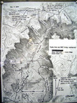
Like other trails/routes in the area, this one is believed to have been created/flagged by the Boy Scouts. Hike The route is shown on a 2004 map I have that looks like it was created by Camp Lo Mia. This description starts from the southern access point where the signage shows a trail splitting off from the Pine Creek Canyon Trail, going to Darling Rocks. The route is simple to follow to Darling Rocks (indicated by a memorial). Past here you will need to rely on Red Tin flags and/or old orange tape or follow the official GPS Route. Some of the flags have fallen off, or over, through the years. It appears to be better marked going up, rather than down Canyon. Until this route makes a turn to the North, it follows close to Pine Creek. Pay close attention when you make the turn out of Pine Creek. It gets steeper and the deadfall gets more aggressive. Many markers may be on the ground or buried. In April of 2020, when I did this, water flowed the entire way. I was curious where it got its name on the map I had. I approached an area that I could see from a distance, that has a series of smooth rock pools and waterfalls. The tallest being around 20' tall. Quite a pretty area and worth the price of admission. Synopsis This would make a nice loop with Pine Creek Canyon Trail from the upper trailhead, CCW, using the old forest roads on top of the rim to connect. Check out the Official Route and Triplogs. Leave No Trace and +Add a Triplog after your hike to support this local community. One-Way Notice This hike is listed as One-Way. When hiking several trails on a single "hike", log it with a generic name that describes the hike. Then link the trails traveled, check out the example. | |||||||||||||||||||||||||||||||||||||||||||||
 Route Editor


