 Route Editor

| Guide | ♦ | 4 Triplogs | 0 Topics |
details | drive | no permit | forecast | route |
stats |
photos | triplogs | topics | location |
| 21 | 4 | 0 |
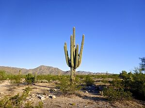
Joy and Pain: Extended Version by kingsnake  From the White Tanks visitors center/library parking lot, head around the south side, 200 yds. past the desert tortoise enclosure and park gate, to where Maricopa Trail crosses Olive Ave. The next 1½ miles are rather rocky. From the White Tanks visitors center/library parking lot, head around the south side, 200 yds. past the desert tortoise enclosure and park gate, to where Maricopa Trail crosses Olive Ave. The next 1½ miles are rather rocky.After 1¾ miles, the route turns east onto a dirt road (Northern Ave.) It is a smooth ¾ mile to Beardsley Canal. Just before the canal, turn south onto the singletrack which parallels the access road.
The route turns south on a paved bike path. South of Montebello Ave. (6 miles), the route becomes gravelly, very wide, shoulder. South of Meadowbrook Ave. (6¾ miles), despite still being on the shoulder, the route actually becomes singletrack for a quarter mile, before finally returning to the paved bike path. At just under 7½ miles, the route arrives at Indian School Rd. Turn west. A mile later, just past Verrado High School, turn left onto the Acacia Way bike path. The route soon crosses the road, traveling through small pocket parks between Verrado houses on the right and a wash on the left. Besides doggie doo bag stations, there was at least one water fountain. At 10¼ miles, the bike path bends to the right. If you look to the left, across some desert, you will see the sewage plant. Turn left there to stay on Maricopa Trail. (It is ½ mile to trailhead-less I-10.) Gate Policy: If a gate is closed upon arrival, leave it closed after you go through. If it is open, leave it open. Leaving a closed gate open may put cattle in danger. Closing an open gate may cut them off from water. Please be respectful, leave gates as found. The exception is signage on the gate directing you otherwise.
Check out the Official Route and Triplogs. Leave No Trace and +Add a Triplog after your hike to support this local community. One-Way Notice This hike is listed as One-Way. When hiking several trails on a single "hike", log it with a generic name that describes the hike. Then link the trails traveled, check out the example. | ||||||||||||||||||||||||||||||||||||||||||||||||||||||||||||||||||||||||


