Overview: The Cold Water Trail #27 is a seldom visited, remote backcountry destination along the backdrop of the rugged Verde Rim with healthy mixed vegetation and unique geology. The trail was originally used by army troops traveling from Fort McDowell to Camp Verde.
When hiking several trails on a single "hike", log it with a generic name that describes the hike. Then link the trails traveled, check out the example.
WARNING! Hiking and outdoor related sports can be dangerous. Be responsible and prepare for the trip. Study the area you are entering and plan accordingly. Dress for the current and unexpected weather changes. Take plenty of water. Never go alone. Make an itinerary with your plan(s), route(s), destination(s) and expected return time. Give your itinerary to trusted family and/or friends.
Only trailheads with six "amenities" have fees. Amenities are picnic tables, trash, toilet, parking, interpretive signing and security.
Directions
Road
Strictly 4x4
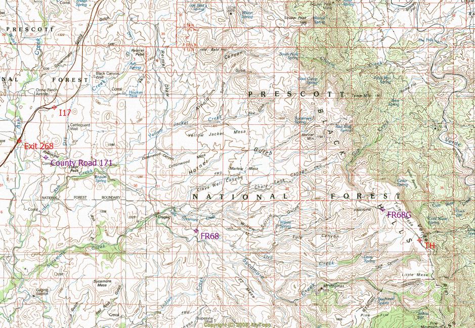
To hike (Upper TH as posted)
From Phoenix take I17 north to "Exit 268" (Dugas). Exit 268 is north of Cordes Junction. From exit 268, drive approximately 8 miles southeast along County Road 171 to Dugas. Continue driving southeast from Dugas along FR68 for approximately 6 miles. From this point, FR68 becomes FR68G. FR68G will begin to climb northeast towards Tule Mesa. FR68G is the main route up onto Tule Mesa heading towards the trailhead. From this point on, FR68G will progressively deteriorate to the point of becoming a high-clearance 4x4 road. Once on Tule Mesa it is approximately 2 "rough and slow" miles to the trailhead. (Caution) FR68 and FR68G from Dugas are impassible when wet. High-clearance four-wheel drive is recommended to reach the trailhead. Stock 4x4 vehicles with "LT" rated tires should not have any problems.
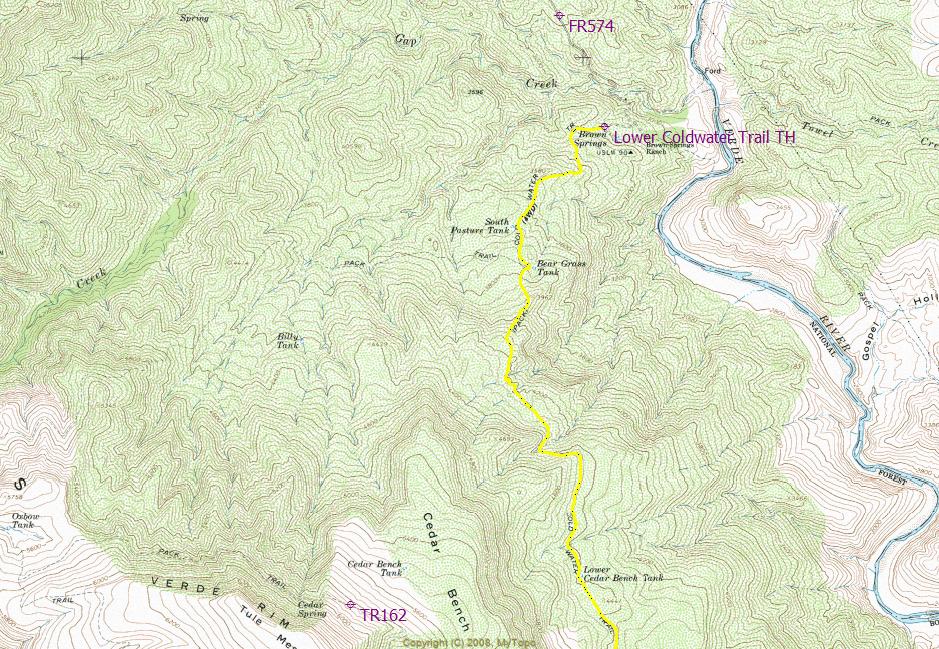
(Lower TH)
Access to lower trailhead is from Camp Verde, via County Road 163 and FR574 to Brown Springs Ranch.
 Route Editor


 Overview: The Cold Water Trail #27 is a seldom visited, remote backcountry destination along the backdrop of the rugged Verde Rim with healthy mixed vegetation and unique geology. The trail was originally used by army troops traveling from Fort McDowell to Camp Verde.


