Route Editor

| Guide | ♦ | 1 Triplog | 0 Topics |
details | drive | permit | forecast | route |
stats |
photos | triplog | topics | location |
| 0 | 1 | 0 |
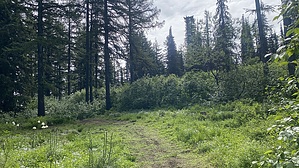
appreciate the large trees by LindaAnn Continue up the dirt road about 0.65 miles to a sharp left turn, while the main road bends to the right. Take that sharp left (almost a U-turn), which turns into a single-track, and continues uphill. Up until now, the incline has hardly been noticeable, but the trail gets steeper from here. Head south and uphill, staying right at the fork for the less steep option, although both trails from the fork will lead to the summit.
Nothing exciting about this hike unless you are either looking for an easy walk or to check off a peak. Continuing north on Huckleberry Mountain Rd does add some scenic value to the hike. Retrace your steps back downhill when you are done. The views on the road seem to be better while hiking back downhill, and you can appreciate just how large the trees are alongside the road. Gate Policy: If a gate is closed upon arrival, leave it closed after you go through. If it is open, leave it open. Leaving a closed gate open may put cattle in danger. Closing an open gate may cut them off from water. Please be respectful, leave gates as found. The exception is signage on the gate directing you otherwise. Check out the Official Route and Triplog. Leave No Trace and +Add a Triplog after your hike to support this local community. | ||||||||||||||||||||||||||||||||||||||||||||||||||||||||||||||||||||||||||||||||||||||