Route Editor

| Guide | ♦ | 2 Triplogs | 0 Topics |
details | drive | permit | forecast | route |
stats |
photos | triplogs | topics | location |
| 24 | 2 | 0 |
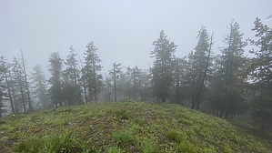
cellular free atmosphere by LindaAnn Hike: From Moon Pass, take the OHV trail/old road heading southwest up from the pass. The first few hundred feet of this hike follows the old road before making a sharp left turn (unsigned) up onto the actual trail at about 0.05 miles. Head southwest on this trail (known as the St Joe Divide Trail) as it winds uphill, generally straddling the boundary between Coeur d'Alene NF and St Joe NF.
Retrace your steps back down from the summit to the main trail, then head back down to the parking area, or if you want to lengthen your hike, you can continue west on the St Joe Divide Trail. Placer Peak is another 2.25 miles or so west as an option. This is an easy hike, even the small off-trail portion, and there are backpacking sites in the area. The small town of Wallace just below the peak is worth a visit as well. I did not seem to have cell service at any point during the hike. Check out the Official Route and Triplogs. Leave No Trace and +Add a Triplog after your hike to support this local community. | |||||||||||||||||||||||||||||||||||||||||||||||||||||||||||||||||||||||||||||||||||||||||