username
X
password
register
for free!
help
 This is likely a great time to hike this trail!  Check out "Preferred" months below, keep in mind this is an estimate.
 

Carnero Creek, AZ

Guide 5 Triplogs  0 Topics
  3.5 of 5  
Fav
Wish
0
details
drive
no permit
forecast
map
stats
photos
triplogs
topics
location
60 5 0
Statistics
tap row or icons for details
Difficulty 1 of 5
Distance Round Trip 1.5 miles
Trailhead Elevation 8,927 feet
Elevation Gain 180 feet
Accumulated Gain 180 feet
Kokopelli Seeds 2.4
 Interest Off-Trail Hiking & Perennial Creek
unreported if dogs are allowed
editedit > ops > dogs to adjust
feature photo
Photos Viewed All MineFollowing
41  2014-05-24 outdoor_lover
3  2012-08-24
Carnero Lake - White Mountains
ssk44
6  2010-05-28 azbackpackr
10  2009-07-26 ssk44
Author
author avatar Guides 16,843
Routes 17,472
Photos 24
Trips 1 map ( 6 miles )
Age 28 Male Gender
Location HAZ, TrailDEX
Associated Areas
list map done
Alpine Region
Historical Weather
Trailhead Forecast
Expand Map
Preferred Aug, Sep, Jun, Jul
Sun  5:54am - 6:40pm
0 Route
 
0 Alternative


remove free decal offer

 Likely In-Season!
Guide Needed
Publish Full Detail Guide


Use +Add above to share photos and triplogs
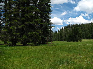
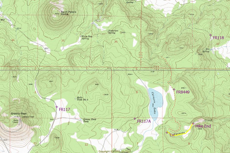
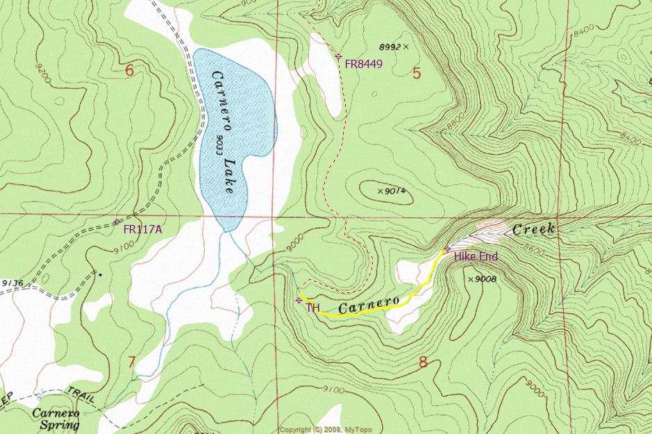
Overview: Carnero Creek is a beautiful spring fed alpine stream located within the Apache National Forest (White Mountains). This unique and seldom visited destination involves a short off-trail hike along Carnero Creek, down into a secluded hidden meadow. The hike ends at stunning boulder filled gorge. Truly a hidden gem.


  • guide related image guide related image
    guide related


Check out the Triplogs.
Leave No Trace and +Add a Triplog after your hike to support this local community.
WARNING! Hiking and outdoor related sports can be dangerous. Be responsible and prepare for the trip. Study the area you are entering and plan accordingly. Dress for the current and unexpected weather changes. Take plenty of water. Never go alone. Make an itinerary with your plan(s), route(s), destination(s) and expected return time. Give your itinerary to trusted family and/or friends.

 Permit $$
None


 Directions
or
 Road
FR / Jeep Road - Car possible when dry

To hike
To reach Carnero Creek from Mesa AZ, take US60 to Show Low. From Show Low, take State Route 260 to FR117, which is approximately 3.40 miles past the turn to "Sunrise Ski Area". Drive North on FR117 approximately 3.25 miles to FR117A and turn right. Drive Northeast on FR117A approximately 4.50 miles to FR8449. From the FR8449 turn, drive approximately 2.00 miles to the trailhead. The trailhead/parking area is just across the creek, near a gated fence crossing FR8449. All access roads other than FR8449 are maintained all-weather roads. High-clearance two-wheel drive is recommended along FR8449. Four-wheel drive is never needed during summer months to access this trailhead. The GPS coordinates for the trailhead/parking area are (Lat. 34 degrees/06'/26.85"/N & Long. 109 degrees/31'/28.67"/W).
page created by ssk44 on Jul 26 2009 9:15 pm
 90+° 8am - 6pm kills
helpcorrectionissue

end of page marker