Route Editor

| Guide | ♦ | 3 Triplogs | 0 Topics |
details | drive | permit | forecast | route |
stats |
photos | triplogs | topics | location |
| 107 | 3 | 0 |
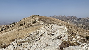
Whining may be necessary by LindaAnn Warning: This is a moderately strenuous hike. There are three long uphill sections, including one uphill section on the latter half of the hike. Nearly all of the hike is above 9,000'. Snow can be an issue well into summer. Late July through September is the best time for this hike.
Coming down from Liberty Pass, the trail skirts around Liberty Lake before turning west, then meandering down towards Favre Lake. Just below Favre Lake, the trail intersects with Kleckner Canyon Trail. You've just lost 1000' of what you gained earlier, and now you get to head uphill again as you stay on the Ruby Crest Trail. Heading uphill, you'll pass through a stand of pines as you switchback your way up about 700' to the next saddle. At the saddle, your second climb of the day is interrupted by a 250' drop towards North Furlong Lake. You can only get a glimpse of the lake from the trail as it heads southeast towards Wines, beginning the final 1000' push to the summit. The trees fade away as you head towards the saddle between Wines Peak and Lake Peak, then head south up to Wines. As the trail tops out, the survey disk is in the rocks on the left (east) side of the trail about 100'. The actual summit is on the right (west) side of the trail, and it is easy to make your way over towards the large cairn and register. Rest and enjoy the views. As you retrace your steps back to the trailhead, enjoy the downhill sections you just climbed, because you still have almost 1300' to regain to get back over Liberty Pass. Luckily that 1000' gain is spread out over about 2 miles. Once over the pass, it is all downhill back to the trailhead. At the north end of Lamoille Lake, the trail splits. The main trail (which you likely ascended) is about 2 miles, but the stock trail is about 1.5 miles. If you stay on the main trail, your hike will come in around 18.5 miles; taking the stock trail lowers the hike to about 18 miles, with fewer people along the trail. Either way, it's a quick hike down to the parking area. Route finding for the entire hike is easy. All intersections are signed. There are many social trails around the lakes, but staying on the most well-worn path keeps you on the main trail. The only cell service seems to be around the saddle between Wines and Lake peaks. Check out the Official Route and Triplogs. Note This is a moderately difficult hike. Leave No Trace and +Add a Triplog after your hike to support this local community. | |||||||||||||||||||||||||||||||||||||||||||||||||||||||||||||||||||||||||||||||||||||