|
Road
High Clearance possible when dry
|
To Courthouse TrailheadFrom Phoenix:
- I-10 west to Exit 81; Salome Rd/Harquahala Valley Road...left
- Harq Valley Rd (it will jig to the right after the overpass) 5 miles to Centennial Rd/Courthouse Rd...right
- Courthouse Rd 7 miles to a junction...right fork along gas pipeline service road
- Pipeline road approximately 4 miles to unnamed road...left (you'll see a sign for the Eagletail Mountains Wilderness
- Unnamed road about 1.5 miles to the TH
Directions to trail: On I-10 west of Phoenix, take exit #81 and head south on Harquahala Valley Road. Turn right on to Courthouse Rock Road, a straight-as-an-arrow packed dirt road that heads directly toward the Eagletail, a.k.a. Courthouse Rock. After 8 miles, the packed dirt road ends at an Eagletail Wilderness sign. Angle right there on to a dirt/washboard gas pipeline road; take it slow and go easy on your axles. Three miles later, look for an Interior Department Wilderness sign on the left and turn left there, angling back toward the Eagletail. The road gets rougher and ends at an Eagletail Wilderness sign at the trailhead. Four-wheel drive and high clearance is strongly recommended but not absolutely required.
11/19/07 crawfrdb writes: From Phoenix, I-10 West about 60 miles to Exit 81. Turn left (south) onto harquahala valley road. Road will "dog leg" before proceeding due south. Go about five miles south to a cross road- see Courthouse road on the left, Centennial Road on your right. Turn right onto Centennial Road. Proceed SEVEN miles (some sources report five miles but the correct distance is SEVEN).
At approx seven miles, you will come to a fork in the road. This fork is an intersection of three roads- a right fork, a left fork and a left turn. You will see a BLM kiosk for the Eagle Tail Wilderness Area just ahead on the left fork, however, proceed on the right fork. The right fork is the long straight road along a high pressure natural gas distribution line.
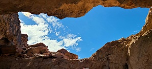
Proceed past a small set of gas pipes on the right, and past/between two small fenced gas control areas about a mile or so later. Continue on this fork for four miles to a left turn- at this road, you will see a "Eagletail Wilderness Area" sign. Proceed approx. 1.5 miles to a trailhead with a typical bulletin board, parking lot and entrance through a fence. Courthouse rock and the Eagletail spires can be seen at this point as well.
Road conditions: As of this writing, a 4WD vehicle is not necessary to access this trailhead. If you are concerned about whether this trail can be accessed without a SUV or other high clearance vehicle, it is possible to access with a sedan or other lower clearance vehicle if you are willing to park a little further away from the trailhead and walk in. Specifically: Harquahala Valley Road going south is paved. Centenial Road is a hard packed, well graded dirt road and in great shape. After the left fork onto the gas pipeline road noted above, the road is not as graded but still fairly well packed dirt with a few short patches of soft, deep sand- keep your speed up going through them and you should be fine.
If you want to attempt this with a sedan, the last 1.5 miles on the road leading into the wilderness area is where you will want to keep an eye out for a place to park. The last half mile will definitely require high clearance. Merely proceed until the road ahead appears too much for your vehicle to handle and park.
From PHX (I-10 & AZ-51) 83.2 mi - about 1 hour 57 minsFrom TUC (Jct 1-10 & Grant) 190mi - 3 hours 38 minsFrom FLG (Jct I-17 & I-40) 215mk - 4 hours 1 min Route Editor

 Overview