 Route Editor

| Guide | ♦ | 1 Triplog | 0 Topics |
details | drive | permit | forecast | route |
stats |
photos | triplog | topics | location |
| 11 | 1 | 0 |
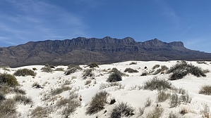
Exponentially Fertile Soil by LindaAnn  Hike: From the parking area's southeastern corner, head east on the dirt road/trail. The dunes are not visible yet, but they will be in just a few minutes. It is abundantly obvious that cattle frequent this trail more often than humans. After about a quarter-mile, you will reach the old parking area, which has another interpretive sign explaining the region's geology. The trail continues to the left of the sign and heads toward the northern edge of the sand dunes. The trail surface is covered in fine sand, making walking somewhat strenuous despite there being virtually no elevation change on the trail. Every plant along the trail also seems to have thorns.
Notes: Sledding is not permitted on the dunes. If exploring in the dunes, pay attention to your surroundings. It is easy to lose track of which direction you need to head to return to the trail. Bring plenty of water; there is no shade. The dunes are open daily from sunrise to sunset. Gypsum: A great source of calcium and sulfur for plant nutrition. It improves soil structure, improves water infiltration, and helps reduce runoff and erosion. Gypsum is also the primary component in drywall.
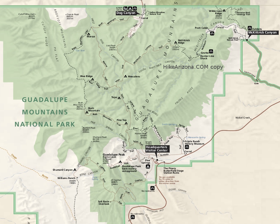
Check out the Official Route and Triplog. Leave No Trace and +Add a Triplog after your hike to support this local community. One-Way Notice This hike is listed as One-Way. When hiking several trails on a single "hike", log it with a generic name that describes the hike. Then link the trails traveled, check out the example. | ||||||||||||||||||||||||||||||||||||||||||||||||||||||||||||||||||||||||||||||||||


