Rainbows are visions, but only illusions by LindaAnn
Overview: Recently designated trail connecting the Beverly Canyon Trailhead (46th St) to the Pima Canyon Trailhead. It can be hiked in either direction between trailheads or incorporated into varying loops with nearby trails.
Hike: From the Beverly Canyon Trailhead, the trail starts from the southeast corner of the parking lot and heads southeast towards the power lines. As you ascend a small rise under the power lines, the trail will turn right and head south, and is signed. Continue south, following the signs as you go. All turns are well marked, and staying on the correct trail is relatively easy.
The north half of this short trail has a little more ups and downs than expected, but nothing steep, and the trail is in reasonably good shape. To the east are views of the city, nearby resort, and some traffic noise from I-10. Views to the west are better, as you get a good view of the eastern areas of the preserve. As you get into the southern half of the trail, it drops down off the hilltops and stays down near some dry washes. The tread deteriorates somewhat and becomes rocky in places.
Continue following the trail signs while numerous trails intersect along the route. The southern half has somewhat more vegetation and fewer views of the surrounding city. As you near the Pima Canyon end of the trail, you'll cross a large wash, then head up to the paved entrance road for that trailhead. The trail ends at the road, and you will be just a few hundred feet directly east of the Pima Canyon parking lot.
If you are starting this hike from the Pima Canyon lot, head east from the lot along the entrance drive. There is a trail (Maricopa Trail) that parallels the north side of the road. A few hundred feet east of the parking area, the trail starts at a break in the fence just before you reach the golf course, and is signed. It immediately crosses a dry wash and continues north towards Beverly Canyon. Continue following the signs as you head north.
When hiking several trails on a single "hike", log it with a generic name that describes the hike. Then link the trails traveled, check out the example.
WARNING! Hiking and outdoor related sports can be dangerous. Be responsible and prepare for the trip. Study the area you are entering and plan accordingly. Dress for the current and unexpected weather changes. Take plenty of water. Never go alone. Make an itinerary with your plan(s), route(s), destination(s) and expected return time. Give your itinerary to trusted family and/or friends.
Permit $$
None
Directions
Road
Paved - Car Okay
To hike To Beverly Canyon (46th St) Trailhead: From Baseline Rd, turn south on 46th St. Take 46th St south to where it ends at the parking lot for the trailhead.
To Pima Canyon Trailhead: From I-10 & Elliot, take Elliot west to 48th St. Turn right on 48th St and head north for one mile. As 48th St curves sharply east and turns into Guadalupe Rd, turn left to stay on 48th St (kind of a confusing turn, stay in the left lane and be prepared to turn left at the curve). As soon as you turn left to stay on 48th, you'll make another left to turn into the park entrance.
 Route Editor

 Overview: Recently designated trail connecting the Beverly Canyon Trailhead (46th St) to the Pima Canyon Trailhead. It can be hiked in either direction between trailheads or incorporated into varying loops with nearby trails.
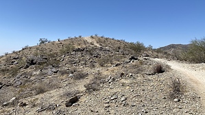


