 Route Editor

| Guide | ♦ | 1 Triplog | 0 Topics |
details | drive | permit | forecast | route |
stats |
photos | triplog | topics | location |
| 8 | 1 | 0 |
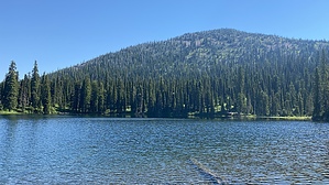
thorn free n pleasant by LindaAnn Hike: The trail is signed at the trailhead and heads east from the road. The elevation gain begins immediately as you head into the forest. The trail itself is in great shape but is very crowded by vegetation. Luckily, none of the vegetation has thorns, so it's just a matter of pushing through the plants as you follow the trail. There are some lazy switchbacks as you head east, then southeast. Views are limited but look behind you to see the old Lunch Peak Lookout to the west. If you're curious, that lookout is accessible from a nearby trail or can be driven up to if your vehicle can withstand the rough road.
Retrace your steps back out when done. Gem Lake Trail is not the most exciting trail but is pleasant and pretty easy considering the elevation gain. Check out the Official Route and Triplog. Leave No Trace and +Add a Triplog after your hike to support this local community. One-Way Notice This hike is listed as One-Way. When hiking several trails on a single "hike", log it with a generic name that describes the hike. Then link the trails traveled, check out the example. | |||||||||||||||||||||||||||||||||||||||||||||||||||||||||||||||||||||||||||||||||||||||||


