 Route Editor

| Guide | ♦ | 4 Triplogs | 0 Topics |
details | drive | no permit | forecast | map |
stats |
photos | triplogs | topics | location |
| 5 | 4 | 0 |
3-4 day backpacking trip by Lizard  Summary: A three to four day backpacking trip in one of Arizona's undiscovered jewels, the Blue Range Primitive Area, linking trails 76, 75, FR281 and trail 73. Summary: A three to four day backpacking trip in one of Arizona's undiscovered jewels, the Blue Range Primitive Area, linking trails 76, 75, FR281 and trail 73.Maps: Blue Range Wilderness and Primitive Area (pub. by Apache National Forest)
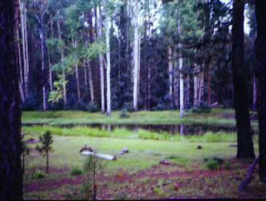
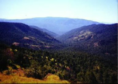
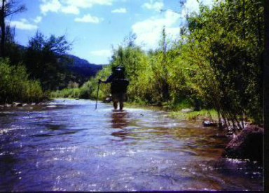
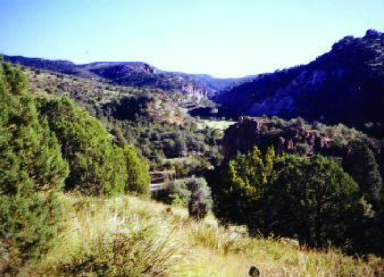
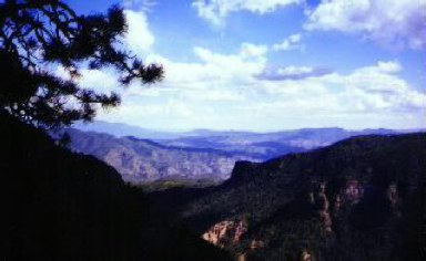
In the meadow, there is a signed junction with trail 75. Turn south on this trail, which descends down into a ponderosa pine forest. While hiking through this forest I heard a canine baying, and to me it sounded deeper in pitch than a coyote. The Forest Service considered the Blue Range wild enough to release wolves into its depths- this fact lead to wild speculation during my hike as to the origin of the baying. Wolves or no, continue along on trail 75. After 3.8 miles from the junction, you reach a spur trail that leads over a rise to White Oak Spring. This spring was gushing water when I visited in August, and I would hazard a guess that it is reliable. Just after the spring, the trail begins a long descent into the Grant Creek drainage. The trail reaches Grant Creek, which was flowing well when I visited, and follows it for several miles down to the Blue River. The Blue River is fairly deep (it came up to my thighs), and it is necessary to ford it to reach the road beyond it. Follow this dirt road, FR 281, south past several ranches nestled in one of the most beautiful canyons I've ever seen. After a few miles, the road crosses the Blue River, and a shallower ford is necessary here. Where the road meets the river, it is possible to hike and rock hop south slightly along the shore. There are big boulders here which shelter small beaches on which a discreet camp can be made. I camped here, and swam up the river to where it flowed down through the boulders. There were several deep pools with cascading waterfalls, and I spent several hours swimming before returning to my campsite. After crossing the river, the road climbs uphill for a bit to a marked trailhead for trail 73 (the Steeple Mesa Trail). Head west on this trail. It climbs steeply up onto KP Mesa. The view during this climb are absolutely outstanding, the best of the trip. On top of the mesa, the trail snakes through a pinyon pine and juniper forest. It may be a bit hard to follow the trail here, as cows graze heavily here and their trails crisscross yours. At any rate, eventually you will reach a corral at Mud Spring. This spring lives up to its name. It was flowing but not that well. It would have been smarter to have gathered water from further up Steeple Creek, which flows intermittantly all the way up. Follow Steeple Creek up, up and up. The trail climbs relentlessly and mercilessly. Eventually, you will top out near a junction with trail 315, the KP Rim trail. It is worth striking out a few hundred feet to the south to check out the view from the KP Rim. From the junction, follow the Steeple Mesa Trail the rest of the way to the Hannagan Meadow Trailhead. This last stretch of trail was my favorite of the entire trip. The conifer forest here is dark, deep and beautiful, and interspersed with brilliantly green meadows. On the whole this is a fantastic trip if you would like to escape to heat and the crowds of most Arizona trails. Check out the Triplogs. Note This is a moderately difficult hike. Leave No Trace and +Add a Triplog after your hike to support this local community. | |||||||||||||||||||||||||||||||||||||||||||||||||||||||||||||||||||||||||||||||||||||


