Route Editor

| Guide | ♦ | 6 Triplogs | 0 Topics |
details | drive | no permit | forecast | route |
stats |
photos | triplogs | topics | location |
| 109 | 6 | 0 |
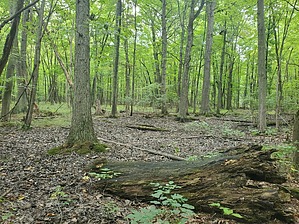
from woods to river and back by Mike_W  This is an easy nature trail walk on the West part of Grand Island, New York that is relatively new and not well known even among local hikers. There are at least 3 popular starting points which are the Assumption Cemetery on Whitehaven Road, West River Overlook, and Nike Base Park off Whitehaven road. Note There are a few loops of trails and there are many ways to shorten or lengthen this hike. The 7 miles roundtrip involves taking the trail from the cemetery to the river and back.
From the Assumption Cemetery, take the blue trail through the woods. There are narrow footbridges to go over low areas that are sometimes wet, especially after heavy rain. After only 800 feet, the blue trail splits into a loop. Turn left and after a total of 0.5 miles, there's an extra optional orange loop that has a roundtrip of 0.5 miles and returns to this same point. Skip the orange loop if you want to bypass this 0.5 miles. Next, continue on the blue trail from this point. After 0.5 miles there will be a junction with a red marker to the left. Turn here and continue. Very shortly, there will be markers for white or green trails but any of these branches should take you to the West near a bridge crossing for the Big Six Mile Creek. The green trail is a more direct route and the white trails loop further North or South and are a few minutes longer. Once across the bridge, there is a picnic area and a trail branch. There are 6 junctions past the bridge and I stayed left at every junction. Eventually, the trail took me past a very large old tree and eventually, river road, and the Niagara river. Take the trail back the way you came to the starting point. There are maps along the way that were a bit misleading and are "currently being updated". The colors on the map didn't seem to exactly correspond to the colored markers I saw on the trees. But, the trail layout seemed to be correct. See my photoset for photos of the map and area. Check out the Official Route and Triplogs. Leave No Trace and +Add a Triplog after your hike to support this local community. | |||||||||||||||||||||||||||||||||||||||||||||||||||||||||||||||||||||||||||||||||||||