Route Editor

| Guide | ♦ | 1 Triplog | 0 Topics |
details | drive | no permit | forecast | route |
stats |
photos | triplog | topics | location |
| 7 | 1 | 0 |
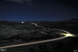
Santa Clara Volcano by Yoder  This is a two-mile round trip up the "Santa Clara Volcano" an old cinder cone from St. George's geological active past. Trailhead parking is just off Utah Highway 18 just North of Snow Canyon State Park. If you are visiting Snow Canyon State Park, this may be a fun hike to check out with some great views.
Lava flow in the area comes from this and another cinder cone. These two cinder cones make up Santa Clara Volcano. One of the youngest lava flows in the Colorado Plateau. Gear Sturdy shoes or boots and long pants are recommended due to the sharp rock and slippery loose gravel/pebbles. Warning Anyone who would not take a fall or slip well should take caution. The trip down, begs for a slip. Hike Cinder Cone Trail starts out pretty flat and wraps around the cone, then starts up the cone. This is a volcanic cone, so there is loose rock on the way up and down, so be careful of your footing. Once you reach the top of the cone, enjoy great views of the area. From here you can see Snow Canyon and St. George off in the distance. Continue hiking around the lip of the cone in a full circle. We did this as a night hike, so I can't post any daytime photos. This is a family-friendly hike. Check out the Official Route and Triplog. Leave No Trace and +Add a Triplog after your hike to support this local community. | |||||||||||||||||||||||||||||||||||||||||||||||||||||||||||||||||||||||||||||||||||||||||||||||