Route Editor

| Guide | ♦ | 2 Triplogs | 0 Topics |
details | drive | no permit | forecast | route |
stats |
photos | triplogs | topics | location |
| 79 | 2 | 0 |
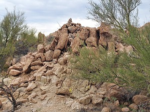
Paint it Red by DixieFlyer  Overview OverviewPeak 2976 is about one mile west of the town of Ajo, in the Little Ajo Mountains. The peak has a prominence of 1,116 feet, and it is the second highest peak in the Little Ajos, being 32 feet lower than Black Mountain, the range highpoint. Etymology The word ajo comes from a Papago word, au'auho, which means "paint", as in the red ore that Indians used to decorate their bodies. Source: Arizona's Names (X Marks the Place), by Byrd Howell Granger
There is no trail on this hike, but there is little, if any, bushwhacking. You'll want to head south and make your way to a ridgeline that you'll follow first southeast, and then south to the summit. From the parking area, follow an old roadbed/a use-trail/open country to the south for about 0.3 miles. If you were to continue in this direction you'd go into a drainage that will take you the wrong way. Instead, go to your right and go up a somewhat steep but short slope to a saddle. From this saddle, you'll be going southwest to another saddle. Along the way, you'll lose a bit of elevation which you'll have to regain. From the second saddle, you'll be able to see the ridgeline that you'll need to get to. You'll see a ridgelet that you'll follow to get to the ridgeline. The going is a bit steep, but it's short. There are some rocks and boulders in your way, but it is easy to go around them to keep the climb at class 2. Once on the ridgeline, you'll be about 1/2 mile from the summit. You'll follow the ridgeline to the southeast for about 1/4 mile. Some of the time you'll stay on the ridgeline, but at other times you'll be on one side or the other of the ridgeline; sometimes you'll go from one side to the other in order to avoid some obstacles and some sketchy places. The author of the guide never encountered anything more onerous than class 2 hiking on the ridgeline. After about 1/4 mile the ridgeline goes due south to the summit. You'll be able to pick up a social trail that goes all the way to the summit, and this last 1/4 mile of the ridgeline is relatively easy. There are expansive, unobstructed views at the summit, you may wish to hang out there for a while. To get back to the parking area, retrace the route that you used to get to the summit. The going will likely be easier on the way back. Synopsis If you are looking for an easy hike on a nice well-groomed trail you will want to find another hike than this one. However, if you want to practice some route-finding skills and if you enjoy some fun scrambling, you will likely enjoy this short but sweet hike. Note The peak and the route described in this guide are on BLM land. However, there is a small parcel of private land to the west of the parking area. Please take care to avoid encroaching on the private property by not venturing very far to the west of the suggested route. Check out the Official Route and Triplogs. Leave No Trace and +Add a Triplog after your hike to support this local community. | |||||||||||||||||||||||||||||||||||||||||||||||||||||||||||||||||||||||||||||||||||||