Route Editor

| Guide | ♦ | 13 Triplogs | 0 Topics |
details | drive | permit | forecast | route |
stats |
photos | triplogs | topics | location |
| 30 | 13 | 0 |
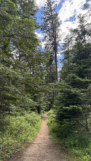
primary by LindaAnn Hike: From the parking area, cross directly across the street to the start of Yellow Loop. There is a sign with a trails map where the trail begins. After walking a couple hundred feet on the trail, it splits for the loop. The loop can be walked in either direction. Taking the left fork gives you two shorter (Blue or Green) loop options if you aren't certain about doing the full loop. Taking the right fork pretty much commits you to the full loop.
Continuing south past the pond, the trail curves to the west as it reaches the boundary of private property. After heading west for a short distance, the loop begins to head back north. There are a few glimpses of Lake Hayden to your left. The northbound portion of the loop has some ups and downs, but nothing steep. You'll cross two more short bridges over some muddy spots. Eventually, the trail curves back to the northeast, completing the loop. Solitude is unlikely on this trail, and besides being popular with hikers and the dog-walking crowd, mountain bikers and equestrians also make use of this trail. Check out the Official Route and Triplogs. Leave No Trace and +Add a Triplog after your hike to support this local community. | ||||||||||||||||||||||||||||||||||||||||||||||||||||||||||||||||||||||||||||||||||||||||||||||||||||||||||||||||||||||||||||||||||||||||||||||||||||||||||||||||||||||||||||||||||