scarlet, vermillion, crimson, burgundy, etc by LindaAnn
Overview: The English Point network of trails has several popular, easy trail options, with the Red Trail being one of the loops. The trail is open to hikers only, no bikes or horses are allowed.
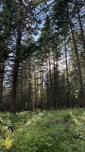
Hike: The Red Trail starts immediately on the east side of the large parking area and is marked by a sign and map of the trails. Red Trail is the longer loop on this side of the road, with a shorter loop (Gray Trail) option available. The loop can be hiked in either direction. Trail markings on this loop are pretty minimal, and the route is not always clear, generally, staying on the largest trail is the correct decision.
The trail is in excellent condition as it makes a short loop through the trees. Elevation change is hardly noticeable in most places. The southeast edge of the loop has a few glimpses of Lake Hayden, including one wood viewing platform. There are several benches along the way as well.
WARNING! Hiking and outdoor related sports can be dangerous. Be responsible and prepare for the trip. Study the area you are entering and plan accordingly. Dress for the current and unexpected weather changes. Take plenty of water. Never go alone. Make an itinerary with your plan(s), route(s), destination(s) and expected return time. Give your itinerary to trusted family and/or friends.
Permit $$
FS
Directions
Road
Paved - Car Okay
To hike From the I-90/US-95 intersection in Coeur d'Alene, head north on US-95 for 6 miles to Lancaster Rd. Turn right (east) on Lancaster for 3.6 miles to English Point Rd. Turn right on English Point and the trailhead will be immediately on your left.
While the entire drive is paved, the parking lot is dirt and has several huge potholes, use caution.
 Route Editor