 Route Editor

| Guide | ♦ | 13 Triplogs | 0 Topics |
details | drive | permit | forecast | 🔥 route |
stats |
photos | triplogs | topics | location |
| 29 | 13 | 0 |
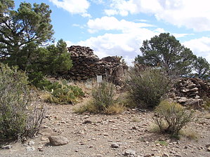
Cowboys & Indians by MEWhiteman   Overview OverviewThis is a 9-mile loop with rolling ups and downs in the Granite Basin Recreation Area southeast of Granite Mountain. The hike goes through forest and scrub with pine and juniper trees, cactus, manzanita, and shrubs of various kinds. There are no steep or sustained climbs and the hike makes use of several connecting trails. At one point on the hike, a short side trail leads to a site built by ancient people in the Prescott area. Hike Park in the day-use area where there is ample parking and bathroom facilities. There is a fee except on Wednesdays when use is free and be sure to get one of the maps next to the pay station. I learned about this hike in Ron Smith's book A Guide to Prescott and Central Highlands Trails, 3rd edition, and basically followed his description.
Continue on trail #347 for 0.25 miles to the junction with trail #345, Mint Wash Trail (N34 38.483 W112 31.292). Turn left here onto trail #345 and follow it to Granite Basin Lake. There was a small brook to our right in several places which was probably draining from Granite Basin Lake. In about 1.9 miles from the junction of trails #347 and #345, you'll come to the junction with trail #352, Mint Wash Connector (N34 37.443 W112 32.446). This could be used as a shortcut back to your car. Continue on trail #345 to Granite Basin Lake. There are bathroom facilities at the near end of the parking lot. After viewing the lake return to trail #345 which takes a sharp left just before reaching the lake. Continue for another 0.3 miles to the end of trail #345 at trail #351, West Lake Trail (N34 36.900 W112 32.766). Turn left here onto #351. In another 0.5 miles you'll pass the junction with trail #348 (N34 36.719 W112 32.360), but continue on #351 back to the Cayuse parking area in another 0.5 miles. Gate Policy: If a gate is closed upon arrival, leave it closed after you go through. If it is open, leave it open. Leaving a closed gate open may put cattle in danger. Closing an open gate may cut them off from water. Please be respectful, leave gates as found. The exception is signage on the gate directing you otherwise. Check out the Official Route and Triplogs. Leave No Trace and +Add a Triplog after your hike to support this local community. | ||||||||||||||||||||||||||||||||||||||||||||||||||||||||||||||||||||||||||||||||||||||||||||||||||||||||||||||||||||||||||||||||||||||||||||||||||||||||||||||||||||||||||||||||||||||||||||||||||||||||||||||||||||


