 Route Editor

| Guide | ♦ | 3 Triplogs | 0 Topics |
details | drive | no permit | forecast | map |
stats |
photos | triplogs | topics | location |
| 50 | 3 | 0 |
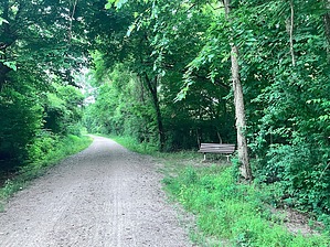
 This trail stretches almost 240 miles in length, going from Machens to Clinton. It is part of a nationwide effort to convert unused train tracks to trails through the Rails to Trails Conservancy. For most of its length, it parallels the Missouri River and passes through a variety of landscapes including: dense forests, farmlands, deep valleys, towering bluffs, wetlands, and remnant prairies. The trail is very flat, being composed primarily of crushed limestone. It passes through numerous towns and communities along the way, having 26 trailheads with differing degrees of amenities. The trail is very well signed and has info boards along the way describing the history of the area and the impact the railroad and/or the Missouri River had upon the area.
History This trail first came into existence in the 1860s when the Union Pacific Railway created a route that eventually had connections going from Chicago to numerous Texas cities. In the 1890’s it was commonly referred to as the K-T (Kansas to Texas). This was seen in the abbreviations of timetables and also as the symbol on the stock market. The K-T eventually became known as “The Katy”. Over the years, the railroad experienced occasional flooding, which led to costly rebuilds and improvements. Then, in 1986, a major flood caused the railway to reroute their track to a line further west. In 1987, through a generous donation by Edward D. “Ted” Jones, a large portion of the right-of-way was purchased and given to the Rail to Trail Conservancy. In 1987, near Rocheport, the first part of the Katy Trail was opened. Gradually, other sections of the right-of-way were acquired, the latest being in 2011 when the segment between St. Charles and Machens was added. With this addition, the Katy Trail grew to 240 miles in length, getting the designation of being the longest contiguous rail-to-trail in the country. Prologue One of the nice things about the Katy Trail is that it is so readily accessible. Numerous roads border it along the way that provides 26 acknowledged THs, with probably at least that many unacknowledged THs. That is a great luxury when you are trying to break down a 240-mile trail. St. Charles is a case in point. Multiple parking spots along the riverfront provide access to the Katy Trail. For this segment, I used the north end of DuSable Park as my starting point. (Almost any spot along the St. Charles waterfront will work, but I chose the north end of DuSable to pick up from where I left off on my northern journey.) At this location, the trail is paralleling the Missouri River. There may or may not be a sign indicating the Katy Trail where you park. However, if you walk towards the Missouri River, you will have to cross over the Katy Trail. It is a large white path, about 8ft wide, that looks like a road. Hike Starting from the north end of DuSable Park, hike south on the Katy Trail. The trail is a large 10-foot-wide swath composed of crushed limestone. The trail is very easy to follow. Once you’re on it, there is little chance of losing your way. Unfortunately, there are not a lot of positives that can be said about the Katy Trail itself. It’s a road. The Katy Trail is more about the history and the surrounding scenery. This stretch of the Katy is unique from the first 12 miles (starting from Machen), as the trail transitions from farmland to city and then back to farmland. This segment starts near milepost 37 and ends near milepost 47. As the trail heads south, you have a forested copse and the Missouri River to the east, and Du Sable Park and the hints of businesses to the west. Du Sable Park stretches for almost a mile and comes and goes as the terrain and businesses allow. At around 0.5 miles, you go under highway 70 with the commons of Du Sable Park briefly fading out and in underneath the freeway. (There are quite a few unmarked use paths that run through the forest that feed off the Katy and stretch underneath the bridge that are a part of Du Sable Park.) At 1 mile, you reach Blanchette Landing, which is the south end of Du Sable Park. This provides nice access/viewing of the Missouri River. Shortly thereafter, you start to enter Old St Charles. There is a lot of cool history in this area, making this an ideal optional starting/ending point so you can enjoy the local offerings. (When visiting, I frequently enjoy the Lewis and Clark Restaurant, which is a block away from the Katy Trail). On the east side of the Katy Trail, you have a nicely manicured Frontier Park, which was one of the last major stopping points before the Lewis and Clark expedition ventured into the unknown. In this spot, you also have the third major stop (St. Charles Station) for the railway when it operated in the 1800/1900s. There is still a rail line and a caboose along the trail in remembrance of the Katy Trail’s historical past. At 3 miles, the trail goes under highway 370, leaving old St. Charles and a wealth of history behind. The trail continues heading south with modern businesses and roads buffering it on the west and forests and canal-like tributaries on the east. Views become less than spectacular as you pass an old quarry and then an aging (though still used) Family Arena, reminiscent of our Coliseum. At around 6 miles, the trail leaves the Family Arena and a nearby road and drops down into a tree-enclosed section. Views are nonexistent, but it is a welcome change from the roadside views. There will be a few bridged stream crossings as well as periodic views of homes nestled in the trees to the west. At about 6.5 miles, you reach highway 364 that passes over the Katy Trail. There will be a signed connector path that leads up to a large parking area. This connector trail is about 0.3 miles in length and provides an excellent access point for the Katy Trail as well as other paved “greenway trails” in the area. This spot will provide your last good look at the Missouri River. As you continue south, you are once again enclosed by trees on both sides. This stretch is pretty cool as you start to see your first hint of elevation, as hills begin to rise to the west of the trail. This is mainly just hinted at because the trees are so thick that you just get an impression of the rising elevation. At 8 miles, the trail crosses a road, exiting the canopy of trees and returning to farm fields on the eastern side. The trail will parallel the road until, at 9.4 miles, the trail arrives at Green Bottom TH. This was the next stop in the Katy Railway and is an ideal TH for those utilizing the Katy Trail. Synopsis This second segment to the Katy Trail brings a little more to the table than the Machens section. This is because of the ongoing changing views that the trail provides - parks, a medley of old and modern structures, farmland, and forested byways - rather than the uniqueness of the trail itself, which continues to be a straight, flat crushed limestone path. The historic significance of this area defines this section and almost mandates taking in the sights and scenes adjacent to the Katy Trail. Check out the Triplogs. Leave No Trace and +Add a Triplog after your hike to support this local community. One-Way Notice This hike is listed as One-Way. When hiking several trails on a single "hike", log it with a generic name that describes the hike. Then link the trails traveled, check out the example. | ||||||||||||||||||||||||||||||||||||||||||||||||||||||||||||||||||||||


