Route Editor

| Guide | ♦ | 3 Triplogs | 0 Topics |
details | drive | no permit | forecast | route |
stats |
photos | triplogs | topics | location |
| 35 | 3 | 0 |
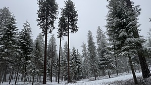
Canfield Gateway by LindaAnn Hike: The loop trail is signed at the start and immediately starts to climb uphill on an easy incline. The loop can be completed in either direction, but this guide follows it counter-clockwise. Stay right at the fork for the loop as you head east. There are a couple of tight switchbacks as you ascend. Note, other social trails run thru the area, so staying on the official route can be tricky at times. Truly getting lost would be next to impossible, as there are neighborhoods on the west and south (downhill) sides of the park.
Making the sharp left, the trail heads west and downhill, winding back to the junction near the bench. It does some long, lazy switchbacks along the way. Once back at the bench, head right to stay on the lower loop. The lower loop heads north, then curves back south to complete the loop near the trailhead. The second half of the lower loop seemed to have the most rocks on the trail surface, but it was all easy hiking. While a very short hike, it is pleasant, and does provide easy access to the Cancourse trails and the National Forest Trails on Canfield Mountain. Check out the Official Route and Triplogs. Leave No Trace and +Add a Triplog after your hike to support this local community. | |||||||||||||||||||||||||||||||||||||||||||||||||||||||||||||||||||||||||||||||||||||