Overview: Monarch Trail is a connecting trail in the city of Rathdrum's StormKing Trail system. It runs upslope from, and roughly parallels, Timber Ridge Lane and StormKing Pkwy, two of the dirt road trails.
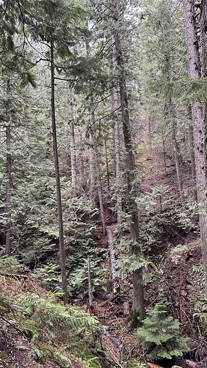
Hike: The south end of Monarch Trail heads north from a junction with Skyline Trail. There is minimal elevation change as the trail contours along the hillside. The trail surface is smooth, packed dirt, and hiking is easy. Plenty of trees for shade, but views do occasionally pop up.
After a short distance, the trail reaches a junction with the Frog Spit Trail. Follow the signs to stay on Monarch. Shortly after that junction, there is a bridged crossing of the South Fork of Branch Spring Creek. The trail continues east and north, with another bridged crossing of a fork of the creek. Then there is another access point from the road. One more bridged crossing, now of the North Fork of Spring Branch Creek, before the trail ends at the junction with StormKing Pkwy and Majestic Passage.
When hiking several trails on a single "hike", log it with a generic name that describes the hike. Then link the trails traveled, check out the example.
WARNING! Hiking and outdoor related sports can be dangerous. Be responsible and prepare for the trip. Study the area you are entering and plan accordingly. Dress for the current and unexpected weather changes. Take plenty of water. Never go alone. Make an itinerary with your plan(s), route(s), destination(s) and expected return time. Give your itinerary to trusted family and/or friends.
 Route Editor


