WARNING! Hiking and outdoor related sports can be dangerous. Be responsible and prepare for the trip. Study the area you are entering and plan accordingly. Dress for the current and unexpected weather changes. Take plenty of water. Never go alone. Make an itinerary with your plan(s), route(s), destination(s) and expected return time. Give your itinerary to trusted family and/or friends.
Permit $$
None
Directions
Road
High Clearance possible when dry
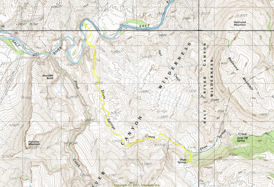
To hike From Mesa Arizona take Highway US 60 to Miami. Turn left at Highway 188 to Roosevelt Lake. Travel 4.5 miles north. The first 4.5 miles of highway 188 have two northbound lanes and two southbound lanes. Stay in the right lane while traveling north. The right lane ends at Wheatfields Road, which is where you will be exiting. Travel northwest on Wheatfields Road while paralleling highway 188 for 1.7 miles through a residential area. At 1.7 miles there is an abandoned slump-block building. Turn right at the slump-block building onto Hicks Road, which will soon go over a bridge crossing Pinal Creek. Pinal Creek is a wide sand wash. Once across the bridge, travel northwest on Hicks Road paralleling Pinal Creek for 2.3 miles to FR219 (Lat. 33 degrees/31'/24.10"/N & Long. 110 degrees/51'/45.60"/W). Just before reaching FR219 you will drive past a large well kept horse ranch on your left. At the beginning of FR219 there is a gate with a "Private Land Access Sign-In Book". FR219 is in a large sand wash. You will be driving through private land for about one mile. The private land ends at a cattle guard in the sand wash. Drive northeast on FR219 from the gate for approximately 5.5 miles to FR223. The sign will say "Shute Springs". Drive northwest on FR223 for approximately 2.5 miles. At that point you will reach a fork where FR223 turns southwest to Shute Springs. The road than continues going straight is FR644. Do not take FR644. From the fork, continue driving on FR223 for approximately 3.0 miles to the trailhead.
 Route Editor

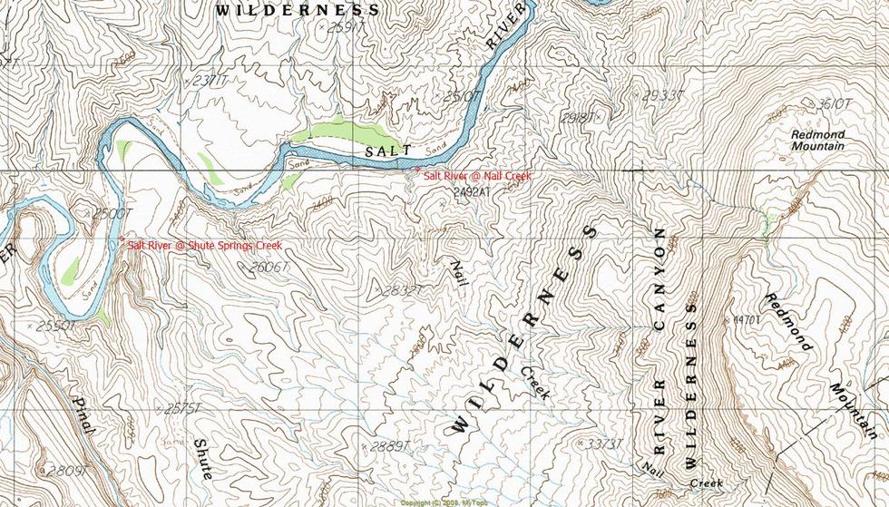
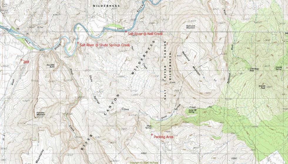
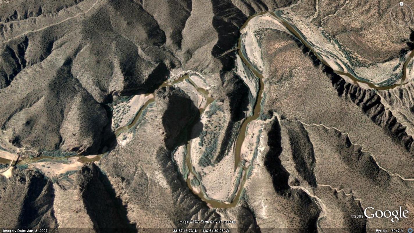
 Overview: Beautiful and remote river segment of the Salt River Canyon Wilderness. Access is strictly off-trail hiking from Shute Springs.