username
X
password
register
for free!
help


Shute Springs Ridgeline, AZ

Guide 2 Triplogs  0 Topics
  3 of 5  
Fav
Wish
1
details
drive
no permit
forecast
map
stats
photos
triplogs
topics
location
12 2 0
Statistics
tap row or icons for details
Difficulty 1.5 of 5
Distance Round Trip 3.8 miles
Trailhead Elevation 4,080 feet
Elevation Gain 385 feet
Accumulated Gain 515 feet
Kokopelli Seeds 6.38
 Interest Off-Trail Hiking & Peak
feature photo
Photos Viewed All MineFollowing
19  2021-04-14
Pinal Shute Springs Loop
chumley
12  2009-03-21 ssk44
Author
author avatar Guides 16,843
Routes 17,472
Photos 24
Trips 1 map ( 6 miles )
Age 28 Male Gender
Location HAZ, TrailDEX
Associated Areas
list map done
Globe Region
Historical Weather
Trailhead Forecast
Expand Map
Preferred Mar, Nov, Apr, Feb
Sun  6:00am - 6:44pm
0 Route
 
0 Alternative


remove free decal offer

  
Guide Needed
Publish Full Detail Guide


Use +Add above to share photos and triplogs
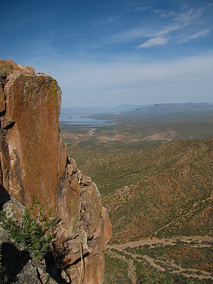
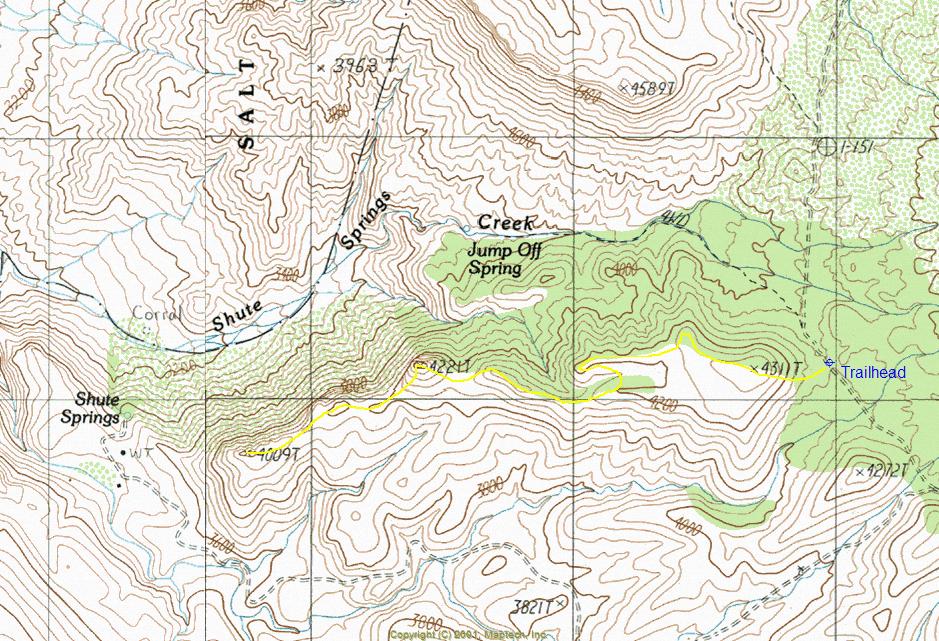
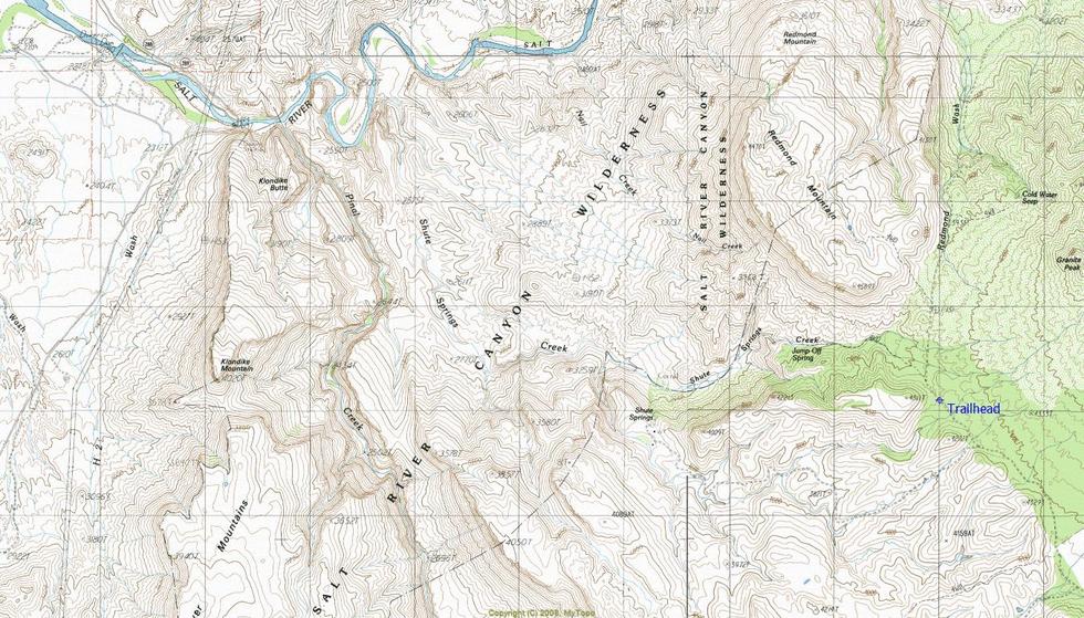
Overview: Shute Springs Ridgeline is a very rewarding and enjoyable off-trail hike. The hike is located in the backdrop of Redmond Mountain and offers great views of the lower Salt River Canyon Wilderness and Roosevelt Lake.


  • guide related image guide related image
    guide related


Check out the Triplogs.
Leave No Trace and +Add a Triplog after your hike to support this local community.
WARNING! Hiking and outdoor related sports can be dangerous. Be responsible and prepare for the trip. Study the area you are entering and plan accordingly. Dress for the current and unexpected weather changes. Take plenty of water. Never go alone. Make an itinerary with your plan(s), route(s), destination(s) and expected return time. Give your itinerary to trusted family and/or friends.

 Permit $$
None


 Directions
or
 Road
High Clearance possible when dry

To hike
From Mesa Arizona take Highway US 60 to Miami. Turn left at Highway 188 to Roosevelt Lake. Travel 4.5 miles north. The first 4.5 miles of highway 188 have two northbound lanes and two southbound lanes. Stay in the right lane while traveling north. The right lane ends at Wheatfields Road, which is where you will be exiting. Travel northwest on Wheatfields Road while paralleling highway 188 for 1.7 miles through a residential area. At 1.7 miles there is an abandoned slump-block building. Turn right at the slump-block building onto Hicks Road, which will soon go over a bridge crossing Pinal Creek. Pinal Creek is a wide sand wash. Once across the bridge, travel northwest on Hicks Road paralleling Pinal Creek for 2.3 miles to FR219 (Lat. 33 degrees/31'/24.10"/N & Long. 110 degrees/51'/45.60"/W). Just before reaching FR219 you will drive past a large well kept horse ranch on your left. At the beginning of FR219 there is a gate with a "Private Land Access Sign-In Book". FR219 is in a large sand wash. You will be driving through private land for about one mile. The private land ends at a cattle guard in the sand wash. Drive northeast on FR219 from the gate for approximately 5.5 miles to FR223. The sign will say "Shute Springs". Drive northwest on FR223 for approximately 2.5 miles. At that point you will reach a fork where FR223 turns southwest to Shute Springs. The road than continues going straight is FR644. Continue going straight on FR644 for approximately 0.5 mile to the designated trailhead. There is no defined parking area. (TH: Lat. 33 Degrees/35'/43.02"/N & Long. 110 Degrees/50'/58.99"/W)
page created by ssk44 on Nov 24 2009 12:48 pm
 90+° 8am - 6pm kills
helpcorrectionissue

end of page marker