Route Editor

| Guide | ♦ | 4 Triplogs | 0 Topics |
details | drive | no permit | forecast | map |
stats |
photos | triplogs | topics | location |
| 12 | 4 | 0 |
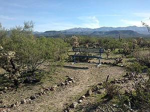
 Overview OverviewA series of short interpretive trails and lookouts with benches. At the north side of the park is playground equipment and a basketball court. Views from the trails include the Southern Bradshaws, Black Mesa, New River Mountains, Agua Fria River, houses, and the I-17. The park shares a trailhead with the Black Canyon Trail. Check out the Triplogs. Leave No Trace and +Add a Triplog after your hike to support this local community. | |||||||||||||||||||||||||||||||||||||||||||||||||||||||||||||||