Route Editor

| Guide | ♦ | 9 Triplogs | 0 Topics |
details | drive | permit | forecast | route |
stats |
photos | triplogs | topics | location |
| 158 | 9 | 0 |
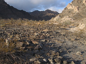
leg-burning, solid rock fun and solitude by sbkelley  Overview OverviewIf you're willing to put in a little up-front effort, this remote and ragged peak will repay your investment many times over. First and foremost, Sheep Mountain (the highpoint of the Gila Mountains), is on the Barry M Goldwater Range. Specifically, it's in the West Management area of the BMGR. Don't let that chase you off: permits are free and obtainable. The BLM office in downtown Phoenix was very helpful in going through the process. A link to detailed instructions is found lower on the page above directions. You must have a permit on you and one in your vehicle while on Sheep Mountain or anywhere on the BMGR or Cabeza Prieta NWR. This hike is no easy stroll, but it's not technically difficult either. The rock is solid, the grade is manageable, and a good pair of lungs and a sense of adventure is all you need beyond your hiking gear. It is a full-body workout, but the spoils of the stunning views of the desert and total solitude far outweigh the costs. If you're ready for a moderate scramble, a great adventure, a new peak to climb, or something new to do around Yuma, this will satisfy you.
Sheep Mountain is located in the extreme southwest part of the state and would be unbearably hot in the summer months. No water and no facilities are available. Once you get your permits from the BLM office, you will be set for detailed maps, and they will be very helpful for navigation. We didn't see any unexploded munitions or bombs on this part of the Goldwater Range, but they could have been lurking - don't touch them if you see them. Hike When Road 4A meets a small side road at the foot of the Gilas, park your vehicle (see TH coordinates for a parking spot). Look for the obvious drainage heading up just to the west of Sheep Mountain. This is your ticket to the top. Enter the drainage a quarter-mile from the TH and relax. The surprisingly solid boulder-hopping in the wash is enjoyable and will test your workout regimen. Two-thirds of the elevation gain will be in this canyon, which begins to steepen and narrow as it gains elevation. No cairns exist but none are needed. Persist up the drainage. Along the way, you'll pass old water storage tanks at roughly 1700' as you rock-hop up the canyon. No major obstacles will block your way until a heinous-looking pour-off at about 2000'. A gentler side drainage appears just to the right of this and allows you a safe alternative from a potentially adventuresome crack-climb. An easy scramble up this side drainage puts you onto gentler (relative term here) terrain. After this, the grade eases to a small saddle at 2350'. Rest here, because it will get steeper. Look up to the east. This ridge looks daunting, but looks are deceiving. Stay on or near the ridgeline, depending on the easiest line, all the way to a small false summit at 3000'. Difficulty stays at or below Class 3 scrambling all the way to here. Along the way, look at the alcoves within the larger boulders along the ridgeline. A grown adult could easily hide in here comfortably (see picture set with desert-boonie demonstrating). Do a short downclimb off to the east (left) side of the false summit, and the ridge turns southeast for the true summit of Sheep. Again, the ridge looks dicey, but easy passage can be found with moderate route-finding. Smile - you've got Sheep all to yourself now... If you find the summit register, which is about the size of a Post-It notepad, you'll note it was placed in 1982 and is nowhere near full. The Barry Goldwater Range and Cabeza Prieta NWR are below you, along with I-8 to the north. Castle Dome and Muggins Mountain are visible beyond that. Stay on top for a while and soak in the views. Return the way you came. Expect your hands to be a little raw by the time you get down from the constant contact with the grainy granite. Water Sources There are the water tanks at 1700', but you'd have to break into them to get near their water. Camping Camping is allowed on the Goldwater Range, as long as you have your permit. Check out the Official Route and Triplogs. Leave No Trace and +Add a Triplog after your hike to support this local community. | ||||||||||||||||||||||||||||||||||||||||||||||||||||||||||||||||||||||||||||||||||||||||