 Route Editor

| Guide | ♦ | 53 Triplogs | 2 Topics |
details | drive | no permit | forecast | map |
stats |
photos | triplogs | topics | location |
| 526 | 53 | 2 |
Signature of the Superstitions by Fritzski  History HistoryOne may be tempted to think that most, if not all of your better-known "Dutch Hunters" spent many hours in diligent research before striking out for the mountains. Yes, indeed many did, but there were a few who spent much of their lives searching for treasure with clues based on nothing more than notions, and there was at least one whose decade-long search revolved mostly around "premonitions" of all things! Celeste Marie Jones was such a person. Alleged to be an ex-opera singer from New Orleans, she came to Phoenix in search of the "Lost Jesuit Gold", a lesser-known and less credible variation of the Lost Dutchman theme. She was somehow able to finance a yearly crew of unsavory characters to help conduct her search, which was centered upon the Needle itself. Throughout the 1950s they routinely set themselves up at Pinion Camp off of the Peralta Trail in East Boulder Canyon and from there conducted their daily searches of the Needle. She was known to "serenade" the Needle at sunset and thus commune with the spirits guarding the treasure within the monolith. She was utterly convinced that there existed a vault within the interior of the Needle which held untold riches in gold, and she was more than willing to not only risk bloodshed, but also literally dynamite that rock to smithereens to get it.
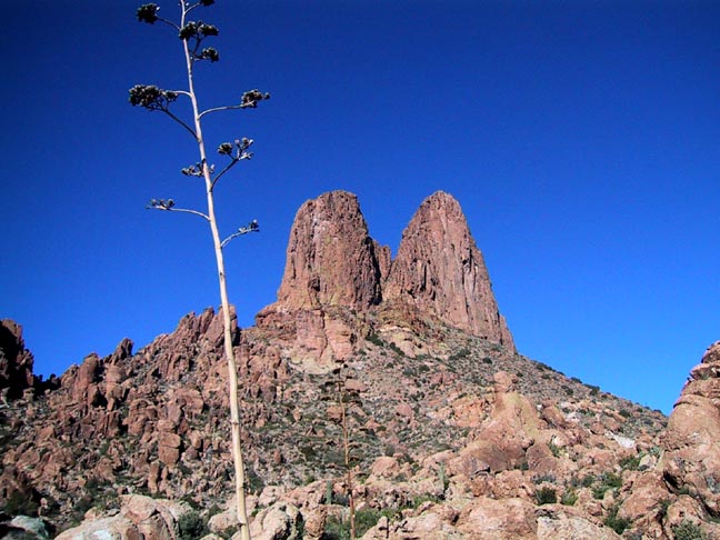
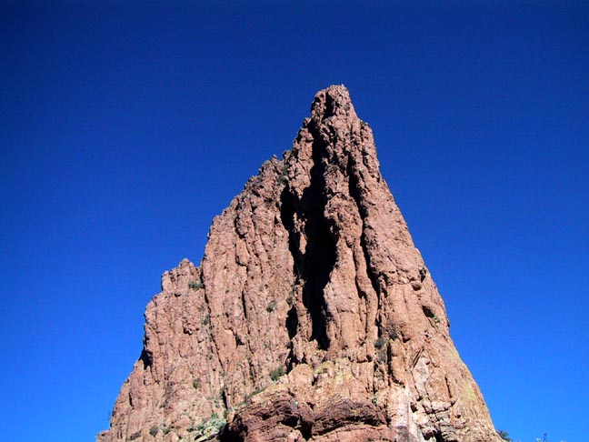
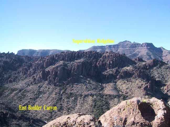
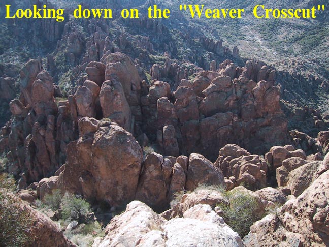
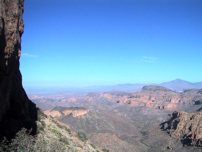
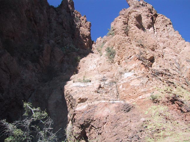
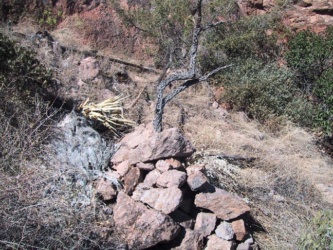
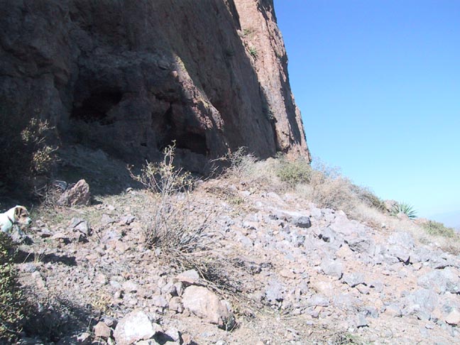
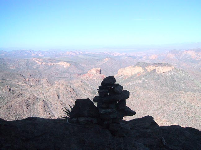
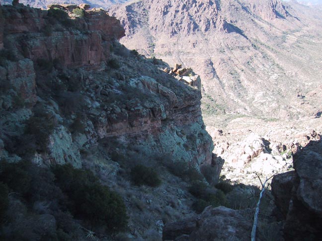
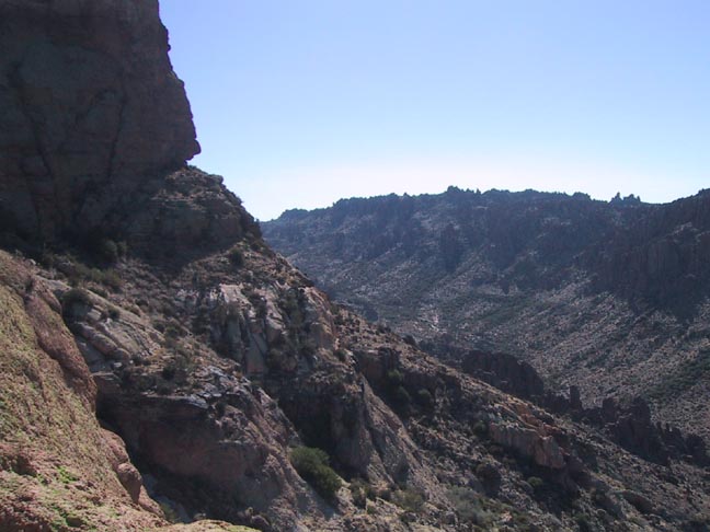
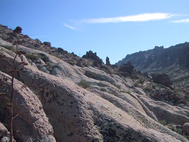
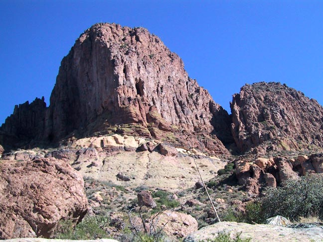
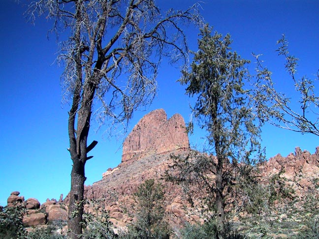
Hike Realizing that most hikers probably don't harbor any great desire to undertake the technical climb to the top of Weavers Needle, this hike is the next best thing. It is for those who want the ultimate close-up view and to reach out and touch this most famous of all Superstition landmarks. The main, or northern spire of this spectacular formation is a column of volcanic rock that majestically rises a thousand feet from the desert floor to an elevation of 4553' and dominates the landscape for miles around. 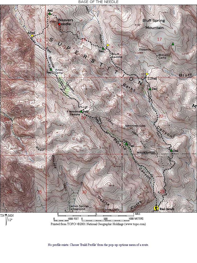 The hike begins at the Peralta trailhead and follows the Bluff Spring trail to the Terrapin trail. It then leaves the trail and proceeds cross-country to the Needle where it circumnavigates the base for approximately 270 degrees from the southern tip, counter-clockwise to the western face. At this point, it descends to the Peralta trail for the return to the trailhead creating an 8-mile loop. The hike begins at the Peralta trailhead and follows the Bluff Spring trail to the Terrapin trail. It then leaves the trail and proceeds cross-country to the Needle where it circumnavigates the base for approximately 270 degrees from the southern tip, counter-clockwise to the western face. At this point, it descends to the Peralta trail for the return to the trailhead creating an 8-mile loop.The portion of the hike on Bluff Spring and Terrapin trails is very straightforward and should one require it, a description is available in the HAZ TrailDEX under "Weavers Needle Loop". For the cross-country portion from the Terrapin trail departure to the floor of Needle Canyon, please refer to the "Weavers Crosscut" description. It is from here, at the very foot of the Needle that this description begins. Be forewarned, looking up the seemingly endless 45-degree slope of loose rocks and boulders ahead is rather daunting. It is, thankfully, not as difficult as it appears. First, let me say that the floor of this canyon is one of the most serene and pleasant places I've encountered in the Superstitions. It is almost surreal as you make your way across the sandy valley floor amid an eerie quiet solitude. The "use trail" as described in the "Crosscut" description that brought you this far begins to fall apart as it winds through a myriad of tiny sandy washes. Basically, follow any open route to make your way to the right side of the first rocky prominence. Here you may soon pick up the continuation of what are probably several different paths, all eventually converging on the Needle. Keep an eye out for abundant cairns and signs of wear. The trail will then take you just to the left of the next small outcropping and begin to follow the crest of a small ridge toward the "notch" in the Needle. It is here that you need to start looking for the trail to bias left toward the small flat area immediately under the southern tip of the Needle, which is your target. I believe this to be a much easier route than some of the more direct paths going straight up and around the ravine under the Notch. It is still steep, but it is clear and the footing is good. Once up at the south tip, take a break. The climb is finished and the views are spectacular. This is a nice spot and there are signs of campsites and a small prospect or cave in the bottom of the Needle. From here all the way along the east face and around to the north side is not difficult and is merely a matter of following a discernible trail along the base of the cliff. You will first pass the large indentation that is the base of the Notch. This is the access point for the easiest and most popular climbing route to the top of the Needle. As you continue along you will encounter numerous small caves, old rusty cans, scrap metal, and large, elaborate cairns whose significance is, or was, known only to the builder. Also in this area is an unusual rock fall. It is of a completely different type and color than the rock composing the cliff and could only have come from far above on the sheer wall. Could this have been the residue of one of Jones' infamous dynamite escapades? As you round the north side you enter an area of perpetual shade, cast in the eternal shadow of the great spire. A full-length climbing rope is left, still strung between carabineers on the face of the north wall. Here you will have to pick one of the ravines and begin a contouring descent to the west. My objective was to remain as high and close to the base of the cliff as possible, but after two aborted attempts resulting in "cliff outs", I was forced off the higher ledges and back down on the slope beneath. Once around the corner, and the apex of the loop at about 4mi, you'll emerge from the shadows and back into the sunlight. You will now have to cross several ravines while trying to stay as high as possible. The reward is a starkly beautiful area of undulating bare rock below the cliffs and overlooking East Boulder Canyon. Continue to contour south to a point directly beneath the western side of the notch where you will intersect a fairly well-worn path heading more or less straight down to the creek bed below. Just follow the numerous cairns and you will soon cross the wash and emerge victoriously on your old friend, the Peralta Trail (4.5mi). Relative to what you just accomplished, you can now enjoy the wide trail and leisurely cruise back as you pass Pinion Camp at @5mi and finally Fremont Pass at @6mi. Warning If you happen to meet anyone on the way back, just be aware that the "wide satisfied smile" on your face may prompt questions about where the heck you went! :) Check out the Triplogs. Note This is a moderately difficult hike. Leave No Trace and +Add a Triplog after your hike to support this local community. | |||||||||||||||||||||||||||||||||||||||||||||||||||||||||||||||||||||||||||||||||||||||||||||||||||||||||||||||||||||||||||||||||||||||||||||||||||||||||||||||||||||||||||||||||||||


