 Route Editor

| Guide | ♦ | 68 Triplogs | 0 Topics |
details | drive | no permit | forecast | 🔥 route |
stats |
photos | triplogs | topics | location |
| 624 | 68 | 0 |
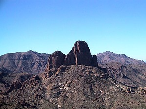
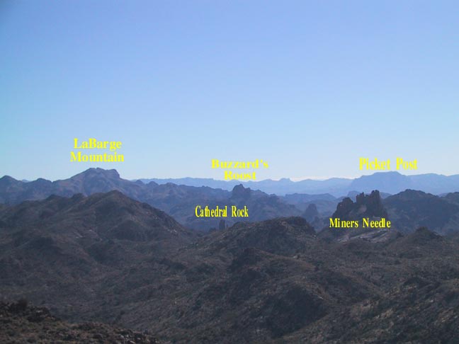
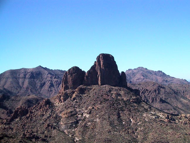
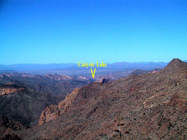
Wide-open beauty by Fritzski  This hike is taken directly from J.Carlson and E. Stewart's "Hiker's Guide to the Superstition Wilderness." It is the suggested loop combination of the Ely-Anderson and Southwest routes. Route finding skills are of absolute necessity for the second portion of the hike. Starting at the Peralta trailhead, you depart north on Bluff Spring trail past the Terrapin trail intersection and to the start of the seldom-used Ely-Anderson trail. This trail of use then ascends Bluff Spring Mountain becoming a cross-country route to several different peaks, and then descends through an opening in the rugged west face to join with the Terrapin trail directly below Weavers Needle. From there, it is a direct route back to the trailhead. This hike is taken directly from J.Carlson and E. Stewart's "Hiker's Guide to the Superstition Wilderness." It is the suggested loop combination of the Ely-Anderson and Southwest routes. Route finding skills are of absolute necessity for the second portion of the hike. Starting at the Peralta trailhead, you depart north on Bluff Spring trail past the Terrapin trail intersection and to the start of the seldom-used Ely-Anderson trail. This trail of use then ascends Bluff Spring Mountain becoming a cross-country route to several different peaks, and then descends through an opening in the rugged west face to join with the Terrapin trail directly below Weavers Needle. From there, it is a direct route back to the trailhead.History: This hike is centered on Bluff Spring Mountain, which could be considered "ground zero" in the history of the hunt for the Lost Dutchman mine. The old trail, supposedly discovered around 1911 by Jim Anderson, a cowhand working for rancher Jim Barks caused quite a stir. Since there were no recreational hikers in those days, finding an old, obscure trail would normally mean only one thing - "mining!" In this case, it was thought to be the result of Spanish miners working there in the early 1800s. This abandoned trail was then shown to famed Dutch Hunter Sims Ely, and the search for a "lost" mine(s) was on. Hence the name Ely-Anderson Trail.
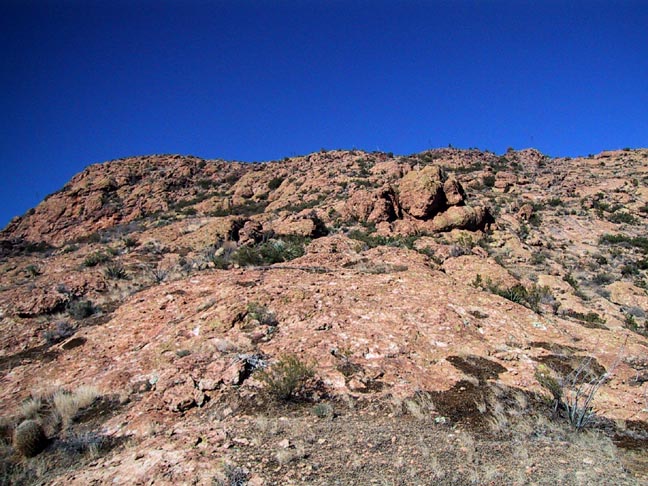
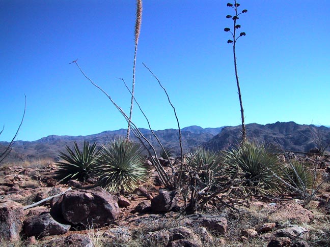
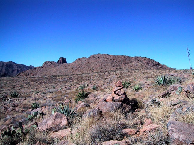
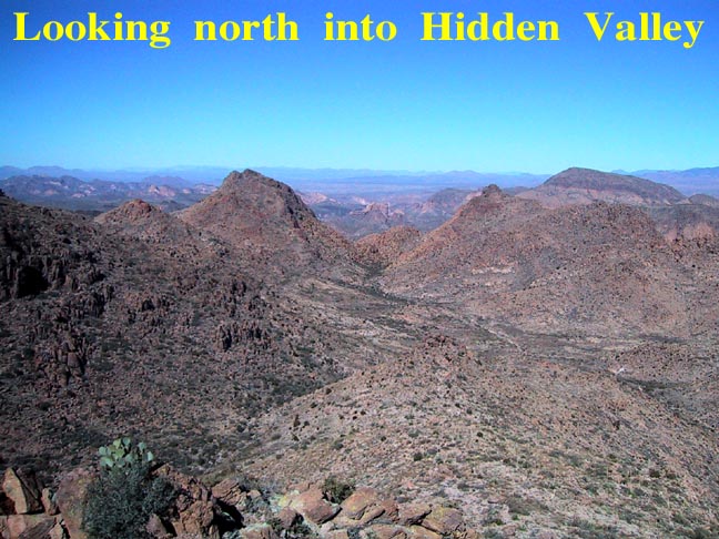
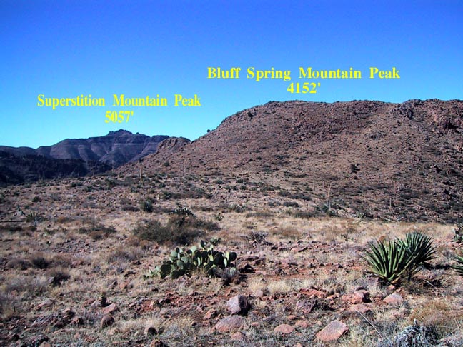
T.E.Glover in his widely respected book "The Lost Dutchman Mine of Jacob Waltz, Part I: The Golden Dream" shows a map placing the head of the trail right at Bluff Spring itself and describes two trails found by rancher Jim Bark (Anderson's employer and Sims Ely's partner). One matching the map: "down the southeast side of the mountain to Bluff Spring," and another closely matching Magill's description: "along the east side of the mountain and down into Mexican Camp." Add to this Helen Corbin's statement in her book "Curse of the Dutchman's Gold." On pg.174, she describes the trail most likely matching Carlson's description as being discovered in relatively recent times by ranch owner Gus Barkley. Although these various and somewhat dubious descriptions would point to another location for the true Ely-Anderson trail, it remains a mystery why anyone would choose such a treacherous route up the sheer east face when the more obvious, easy, and closer access is up the relatively mild slope of the southeast corner. Hike: Not only is Bluff Spring Mountain one of the more massive features of the Superstitions, but also one of the least accessible. It is so large that it contains its very own valley appropriately named "Hidden Valley." There are only three generally accepted points of access to the mountain. The first and most accessible being the Southeast approach described herein. The second and more difficult would be the breach in the west face that we will use on our descent to the Terrapin Trail. Third, and possibly the most difficult, is a rumored and formally undocumented route through the opening at the extreme north end. I guess there would be a fourth way if Magill's route up the east side still exists or ever did. We start by taking the Bluff Spring trail past the Terrapin trail intersection heading east into Bluff Spring Canyon. To find the beginning of the Ely-Anderson trail (@ 3mi), look for a sandy open area on your left as you approach the southeast corner of the mountain. After the trail follows the creek bed through a narrow slot and just before the Dutchman trail intersection, at this point, proceed up the slope on the low ridge, and you will quickly discover a well-worn and easy to follow trail to the top. Continue to follow the trail as it gradually meanders its way up and around the ridge, taking ample time to stop and enjoy the beautiful views behind you. There are many bare rock sections rumored to be so due to the wear of many horse and mule caravans employed by the ancient Spanish miners. Once near the top, you will notice a low stone wall (@3.5mi) whose use is theorized to be either a Spanish defense of the top from marauding Apaches or, less romantically, from hungry cows. The terrain at the top is starkly beautiful. It is uncharacteristically flat, open grassland punctuated only by huge century plants, Sotol, and Ocotillo. Just beyond the 4mi. point the trail begins to fade but is no longer needed as the ground is so wide open that you can visually spot the high point to your north and proceed as you like through the gently rolling grassland. Rabbits and signs of deer are abundant. Once at the high point (4.5mi) of the eastern ridgeline shown as "4041" on the topo, you will be rewarded with stunning views of Hidden Valley below and LaBarge Canyon to the east. This makes an excellent spot for a lunch break. This is the end of the Ely-Anderson portion of the hike and a good return point for those not desiring the more strenuous continuation on the Southwest Route. A highly suggested intermediate option would be to continue as far as the 4152' peak of Bluff Spring Mountain (4.75mi) and then return from there. To get there is merely a matter of sighting the peak to the east and contouring your way along the open terrain and over a gentle saddle connecting to the west side. The views of the Needle from this point are fantastic, and there is a large hollow cairn containing an ammo box and the obligatory sign-in log. The last visitor was over two months ago with dates going back over twenty years to 1980. The continuation of the Southwest Route from here becomes quite difficult. Although you can easily spot the Terrapin trail directly below, it is imperative that you avoid a direct route and stick as close as possible to Carlson's prescribed route to avoid inevitable "cliff outs." As you proceed northwest along the gradually descending ridgeline, you will encounter some very rugged terrain consisting of steep, loose rock mixed with the occasional scramble around boulder outcroppings. Once at the top of the ravine (@5.5mi), again, I highly recommend following Carlson's advice to cross over and stay on the northern slope to avoid the brush-choked bottom. The ravine eventually makes its way to the Terrapin trail, and at this point, I elected to deviate slightly from J.C.'s route and stay with it to a nice smooth rock area in the bottom rather than short cut southwest across the slope. At the bottom of the ravine, follow the creek bed over to the Terrapin trail (@6mi) for a quick break in the shady trees and then back to the trailhead (9.5mi). Jack has suggested to me that a good hike would be a thorough search of the East face area north of the Springs for any signs of the E-A "ghost" trail so vividly described as being in that area. An excellent opportunity for one to possibly shed some light once and for all as to its actual existence - and post their findings on this very site! Check out the Official Route and Triplogs. Note This is a moderately difficult hike. Leave No Trace and +Add a Triplog after your hike to support this local community. | |||||||||||||||||||||||||||||||||||||||||||||||||||||||||||||||||||||||||||||||||||||||||||||||||||||||||||||||||||||||||||||||||||||||||||||||||||||||||||||||||||||||||||||||||||||||||||||||||||||||||||||||||||


