 Route Editor

| Guide | ♦ | 18 Triplogs | 1 Topic |
details | drive | no permit | forecast | map |
stats |
photos | triplogs | topic | location |
| 204 | 18 | 1 |
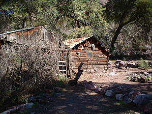
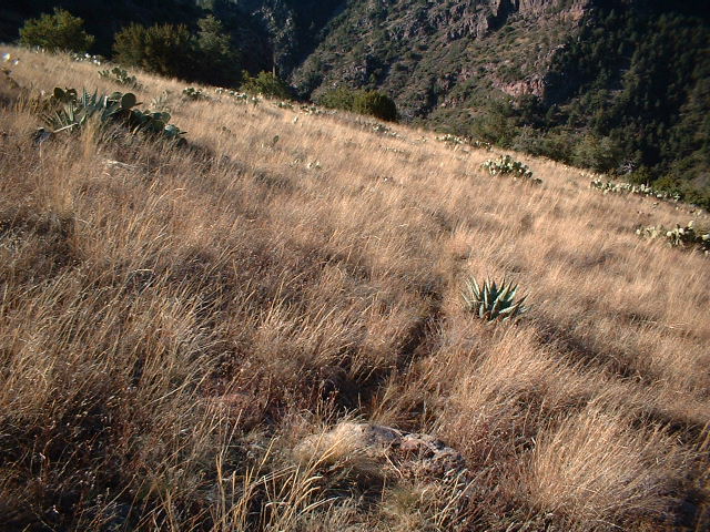
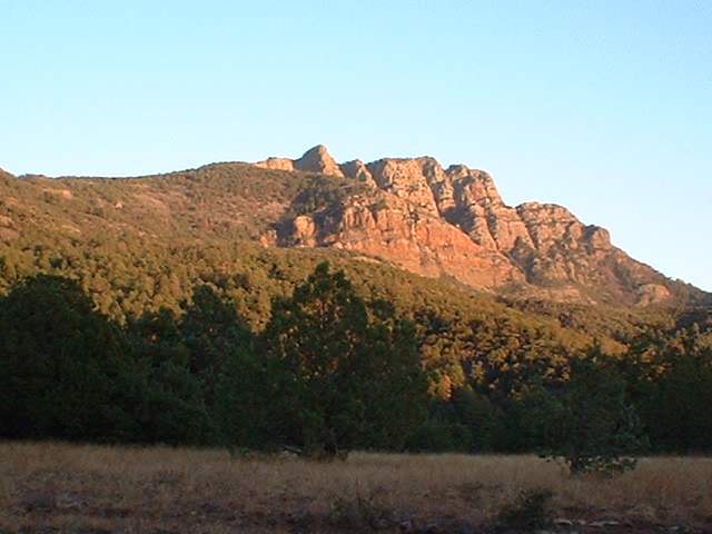
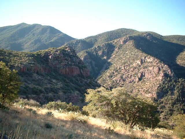
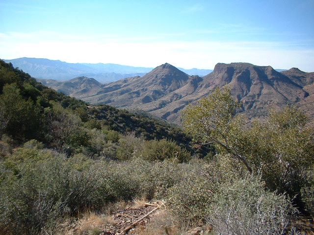
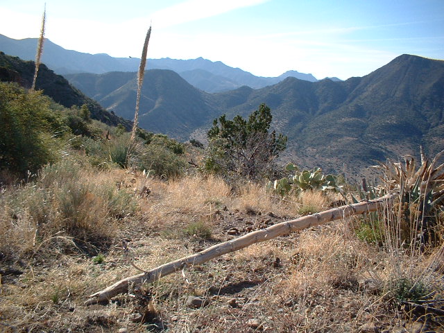
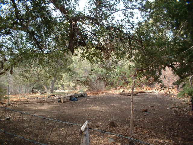
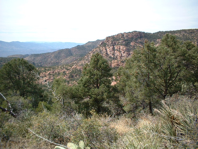
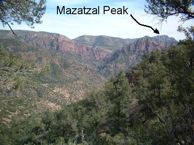
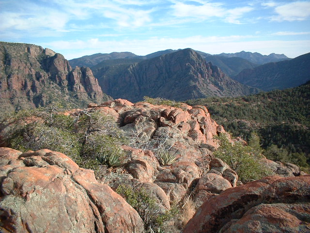
Challenging by Lizard   A word of warning: Once you get west of the Mazatzal Divide, all of the Mazatzal Wilderness trails are faint and hard to follow. In some places, they are nonexistent. This is a typical Mazatzal trail. Do not attempt this hike unless you have map and compass skills and experience following poorly defined trails. Be prepared to cairn-hunt. A word of warning: Once you get west of the Mazatzal Divide, all of the Mazatzal Wilderness trails are faint and hard to follow. In some places, they are nonexistent. This is a typical Mazatzal trail. Do not attempt this hike unless you have map and compass skills and experience following poorly defined trails. Be prepared to cairn-hunt.The beginning of this hike follows the Barnhardt and Mazatzal Divide Trails to Chilson Camp. Read the Barnhardt Trail description for details on this. Chilson Camp is a great place to camp. Each night the setting sun lights up Mazatzal Peak. Look around the southwest corner of Chilson Camp to find the Davenport Wash trail junction. The trail swings south around 6240' peak, growing fainter and fainter as it rounds the mountain. On the west side of the mountain, the trail switchbacks down into the South Fork Deadman Creek canyon. The topo map (USFS Mazatzal Wilderness) is deceptive here. It shows a fairly straightforward drop into the canyon, but the actual trail heads south along the canyon's rim quite aways before dropping into the canyon. I dropped into the canyon too soon and ended up having to scramble down a 20 ft. rock wall. This would have been very dangerous for someone without rock climbing skills, so please be careful and try to stick to the trail itself. South Fork Deadman Creek canyon is very scenic and would be interesting to explore upstream.
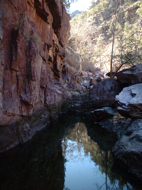
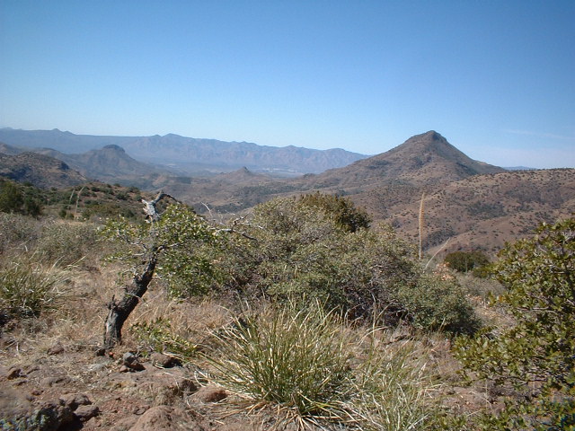
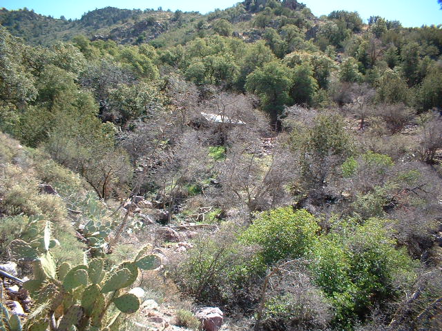
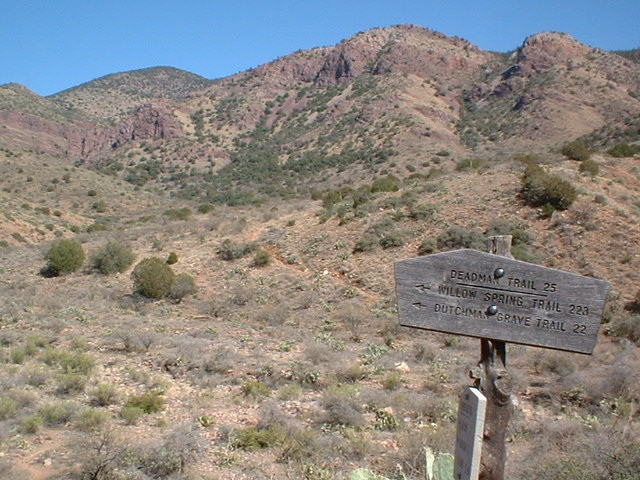
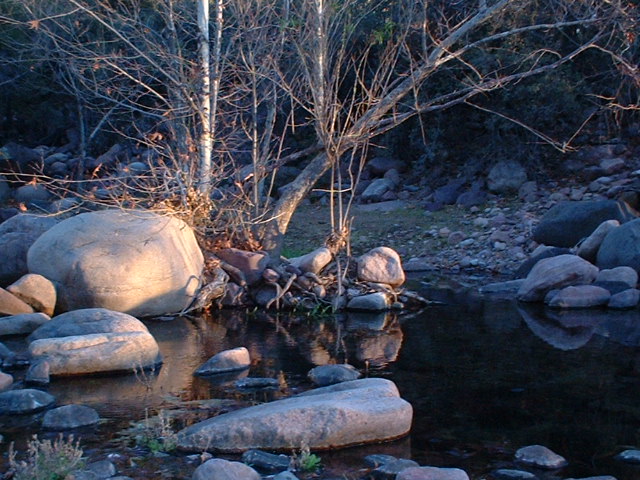
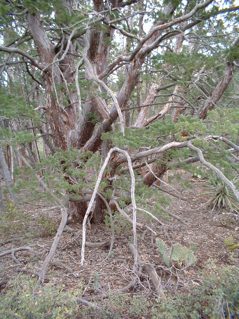
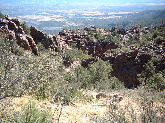
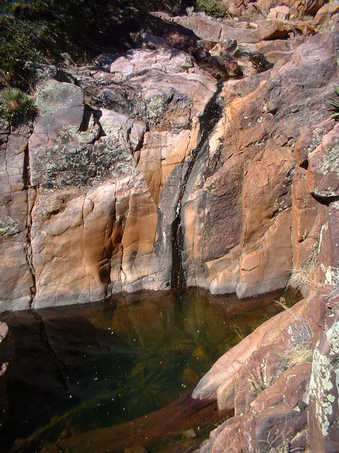
Back on the main trail, you will drop down to cross Davenport Wash. On the far side of the wash, you'll come to the junction with the Deadman Trail. Take the Deadman trail, which climbs very steeply up to an unnamed pass east of Table Mountain, with spectacular views and plenty of cowpies. The view to the north shows you the next ridge you'll be crossing. The trail drops steeply here down to Deadman Creek. There are nice campsites here, if you don't mind cowpies. According to Mazel, this is one of the largest creeks in the Mazatzals and usually flows well into midsummer. It had a very good flow when I was there. I actually had to ford it. The trail, as it crosses Deadman Creek, is a bit confusing. It drops away from the mountain to meet a fence along the creek. There is a large gate where the trail meets the creek, which would make you think the trail crossing is right there. In reality, the trail turns to the left (west) and parallels the fenceline for 200 yards to another gate, where the trail crossing is. The creek crossing is well-cairned, so if you cross in a place with no cairns, you're in the wrong place. On the north side of the creek, the trail makes a long, shadeless, and steep ascent up a scenic ridge to a saddle. There are great views atop this saddle. Once on top, the trail swings east to ascend even further up the ridge. It levels off and cuts through open pinyon pine and juniper forest to a signed junction with the Willow Spring Trail. Turn right (east) on this trail, which quickly passes a signed junction with the Dutchman Grave trail, then reaches a signed junction with a spur trail to Mountain Spring. Mountain Spring offers water year-round (according to Mazel), very welcome shade trees, and excellent camping. The trail from Mountain Spring climbs briefly, then begins descending to Lost Spring. There are spectacular views of the Mazatzal Divide here, which will only get better and better as the trail goes on. I was unable to find Lost Spring, however. The trail crosses a narrow, very scenic ridge. It offers views to the west of Granite Basin and the Mazatzal Divide. The trail here is also very, very brushy. You will lose the trail a dozen times in the brush from here to the Park. Make sure to wear long pants. The trail ascends along Midnight Mesa to a signed junction with the Midnight Trail, where you stay to the right (east) on the Willow Springs Trail. The trail climbs over a small hill in a strange juniper forest and crosses a sandy wash, then climbs steeply up an unnamed 6320 ft. mountain. The trail designers here obviously do not believe in switchbacks, as the trail goes straight up and over the mountain. Great views are found all along this climb. On the other side, the trail finally moderates, and it is a fairly easy walk through alternating forests of juniper and ponderosa pine to the "Park". The Park is a gorgeous area of towering ponderosa pines, with great campsites. You can sometimes find water here in nearby Pete's Pond. In the Park, you'll reach a signed junction with the Mazatzal Divide Trail. Turn south on this trail, and follow it through ponderosa pines, pinyon pines, and junipers as it climbs over a series of three ridges. After crossing the third rocky ridge, you'll drop down to a junction with the Rock Creek trail. This trail climbs past the campsites at Hopi Spring (bone dry) and steeply up to a pass. Once on the pass, the trail begins a long descent back down to the Barnhardt Trailhead. It switchbacks back and forth, occasionally passing scenic ridges of rock. You will soon drop into a canyon, where I found a good flow of water. Just before climbing back up out of the canyon, you will pass a large pool with waterfall. This pool was big enough to swim in, and it would likely make a good day hike destination from the Barnhardt TH. I believe it is about 7 miles from the pool to the trailhead. The trail continues its torturous descent. After several miles of shadeless switchbacks through manzanita and scrub oak, you will eventually drop into a shady canyon to meet the Wilderness boundary sign. The trail turns east here and follows the canyon for a half-mile or so. This trail was home to more cows than I've ever seen in any one place before. I passed at least a dozen cattle altogether. There are water and shady campsites in this canyon, but neither is very attractive with the numerous cows. Near the end of the canyon, the Rock Creek trail turns into the Half-Moon trail, and there is a sign denoting this fact. There is also a road cutting through this point, making finding the Half-Moon trail rather confusing. Be sure to look for the cairn. The trail climbs onto a small ridge, then drops down the other side to cross a huge wash. For your hiking pleasure, this wash features a walk straight through a gigantic field of catclaw. Beyond the wash, the trail continues to snake around the small ridges and foothills of the Mazatzals. After passing through a gate, the trail drops to cross the wash of Barnhardt Canyon and climbs up the other side to the trailhead. Gate Policy: If a gate is closed upon arrival, leave it closed after you go through. If it is open, leave it open. Leaving a closed gate open may put cattle in danger. Closing an open gate may cut them off from water. Please be respectful, leave gates as found. The exception is signage on the gate directing you otherwise. Check out the Triplogs. Leave No Trace and +Add a Triplog after your backpacking trip to support this local community. | |||||||||||||||||||||||||||||||||||||||||||||||||||||||||||||||||||||||||||||||||||||||||||||||||||||||||||||||||||||||||||||||||||||||||||||||||||||||||||||||||||||||||||||


