 Route Editor

| Guide | ♦ | 29 Triplogs | 4 Topics |
details | drive | no permit | forecast | 🔥 route |
stats |
photos | triplogs | topics | location |
| 368 | 29 | 4 |
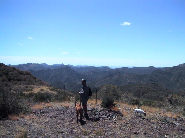
A Shady Cruise by Fritzski  History HistoryIt's believed that in 1873 US troops used points along this creek as campaign headquarters during General George Crook's regime. Overview This is an enjoyable hike through the Eastern Superstitions along Campaign Creek. It is a gradually climbing "out and back" route that follows the Campaign Trail (#256) and takes you past the creek's headwaters and up to the Campaign / Pinto Divide. This is the ridge that defines the separation of drainage on the north side into Campaign Creek and to the south into Pinto Creek. Both eventually drain into the Salt River to the north.
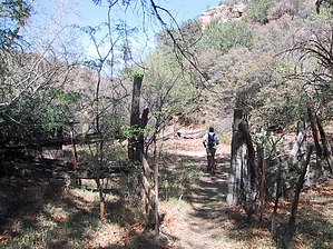
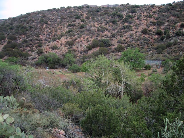
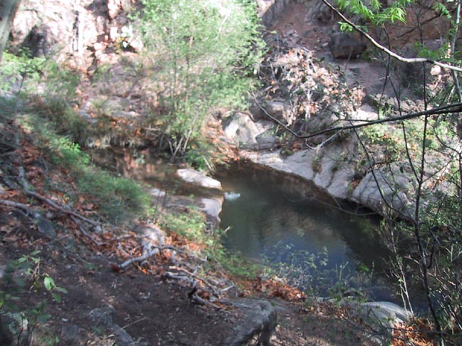
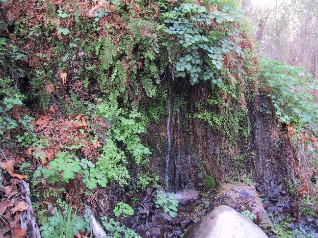
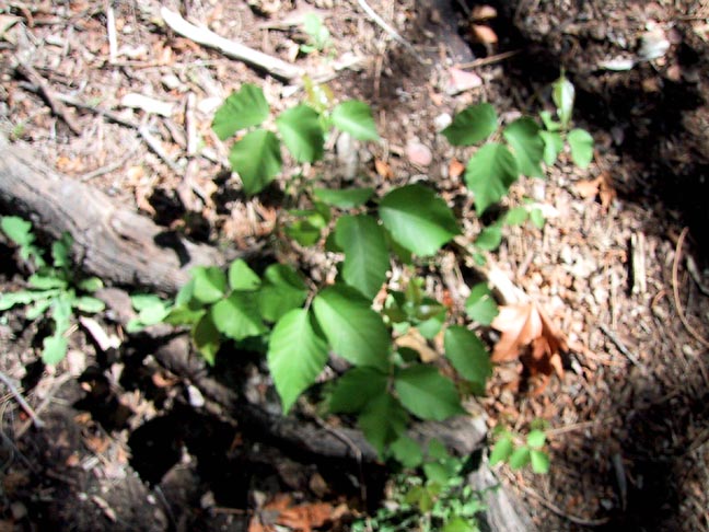
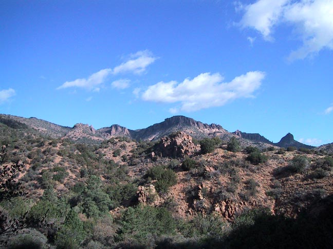
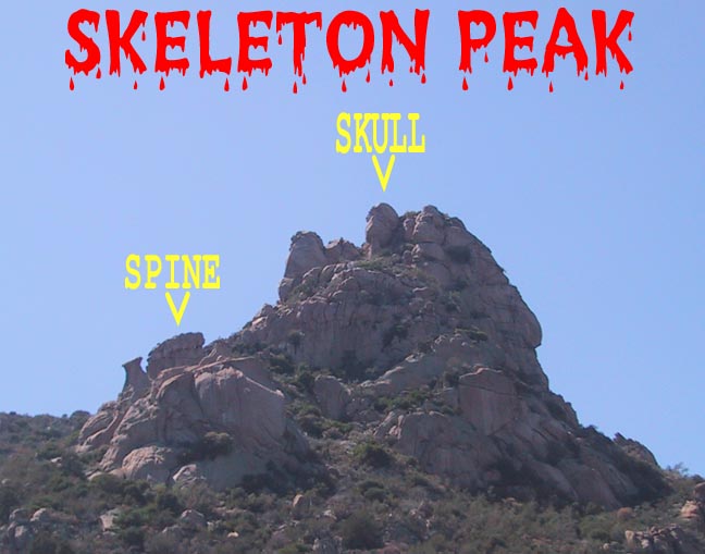
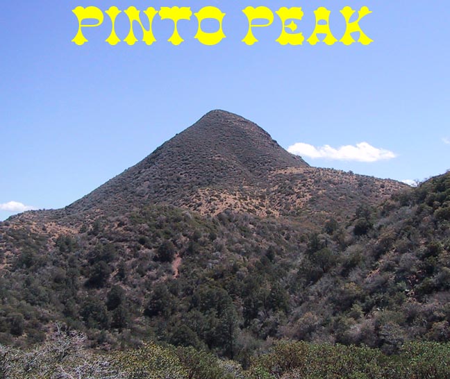
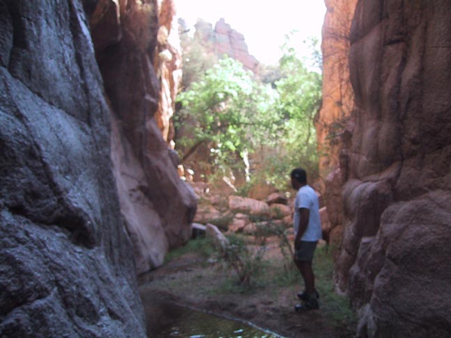
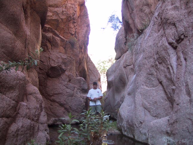
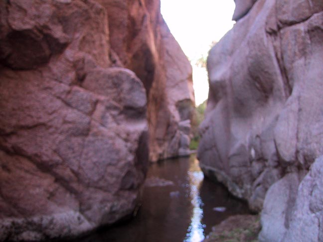
From the Campaign Trailhead, continue about 0.2 miles southwest on the dirt road to the trail's signed start. The trail climbs up onto the northwest slope of the creek bed and offers some nice views down into Reavis Mountain School along the way. After passing the school, you drop back down into the bottoms where numerous crossings of the permanently flowing creek are required. This is a pretty area, and along the way, at about 0.8 miles, you'll notice a fairly vigorous spring emerging from the left bank of the hillside. This is depicted on the topo quad as merely "Springs," but if you look closely, you'll see suspended plumbing running back down to the school, indicating this as their source of potable water. At about 1 mile, you'll reach the Reavis Gap Trail intersection, where we stay left on the Campaign Trail. Beware of copious stands of Poison Ivy lining the edge of the wide trail. Continue the steady but gentle climb south, where at about 1.5mi, you climb a small saddle/ridge that shortcuts a "horseshoe" shaped bend in the creek. It is here that the "flowing" water in the creek originates. From atop the ridge, you get your first views of the local terrain surrounding the valley. Quickly descending back into the creek bed, the trail meanders nicely from side to side and was possibly the most well-maintained trail I've seen to date. It appeared as if the trail crew had been through just days before and spent a lot of time on "manicuring" the trail instead of just brushing it out. Personally, I'd rather see less detail and more mileage - oh well. At about two miles in, look for a peculiar and interesting rock formation towering above you on the right. We named it "Skeleton Peak". Continue through a scenic old corral area and at about 2.5mi, there are some nice pools at the intersection with the side ravine labeled "Spring" on the topo. Another half mile will bring you to the intersection of the now-defunct Pinto Peak Trail. The Forest Service recently decommissioned this trail, and in addition to discontinuing any maintenance, they seem to have gone out of their way to erase any sign of it. If you look closely though, you can see where it goes up the center of a ravine heading east. I've heard the hike up this trail to Mountain Spring is very nice, and there was a seep spring just a short distance up. I would hope not to see this trail lost to lack of use. At about 4mi, you come to Brushy Spring. This will most likely be your last source of reliable water. The Fire Line Trail lay just ahead at about the 5-mile point. This is a lovely spot for a break and marks a changing point in the hike for several reasons. It sits in a beautiful little stand of Ponderosa Pines and marks the last of the predominant shade (unfortunately, my camera has taken one too many spills, and about every other photo comes out blurry :=( It also marks the end of the trail maintenance, and things get significantly brushier from here. Lastly, the climb begins to get gradually more aggressive and continues that trend exquisitely to the very top. The last half-mile is a bit of a grind, consisting of a steep scree surface winding through the dense Manzanita. Views of the prominent Pinto Peak (5991') begin to dominate the skyline to your left as you near the top. The thick jungle covering it from top to bottom dispelled any previous notions I may have had about someday climbing it. The top of the divide, on the other hand, is windswept and open, providing for nice views south into the West Fork Pinto Creek drainage and the beautiful Oak Flat area where there is a confluence of five trails and nearly as many creeks. From here, the return is back the way you came. For those desiring something a little less than almost fourteen miles, a gentler overall climb, and exquisite trail conditions, the ten-mile RT hike to the Fire Line intersection would provide the majority of the beauty that is to be seen on this hike. As with many "stream following" trails, I felt that there were many times that we were up on the side slope and missing much of the riparian beauty below. If I were to go back (and I will!), I want to attempt to follow the creek bed itself upstream from the above mentioned "small saddle/ridge"(1.5mi) to Fire Line Trail, then return via the normal trail. Just as a last note, if you have any time or energy left over, there is a concise and worthwhile side trip to be explored on the drive back out. It is a very cool little slot canyon. You can catch a glimpse of this narrow opening from your car by looking directly left as you descend the only "4X4" hill back down to the cattle gate. The easiest access is to park right in the sandy drainage at the side of the road just before the gate. From here, it is a short and scenic stroll up the sandy wash as the walls continue to close in around you. If you have sandals, take them or just wade barefoot through the clear water flowing over the sand. Ever hear the "babbling brook" on one of those relaxation soundtracks? This is where they recorded it. Gate Policy: If a gate is closed upon arrival, leave it closed after you go through. If it is open, leave it open. Leaving a closed gate open may put cattle in danger. Closing an open gate may cut them off from water. Please be respectful, leave gates as found. The exception is signage on the gate directing you otherwise. Check out the Official Route and Triplogs. Leave No Trace and +Add a Triplog after your hike to support this local community. | ||||||||||||||||||||||||||||||||||||||||||||||||||||||||||||||||||||||||||||||||||||||||||||||||||||||||||||||||||||||||||||||||||||||||||||||||||||||||||||||||||||||||||||||||||||||||||||||||||||||||||


