 Route Editor

| Guide | ♦ | 14 Triplogs | 0 Topics |
details | drive | no permit | forecast | route |
stats |
photos | triplogs | topics | location |
| 79 | 14 | 0 |
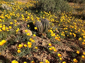
 GET Segment 4 overview GET Segment 4 overviewThe remote Tortilla Mountains extend south from the Gila River toward the distant Santa Catalina sky island range, and we follow their lead in this segment, winding among Sonoran desert foothills and mesquite-lined washes, and encountering few if any people. Except for the first 8 miles or so, the terrain here is fairly mellow. Navigation is also relatively straightforward, though the Arizona Trail route that you'll follow changes surfaces frequently - from singletrack to 4WD road and back - so be alert at junctions and look for cairns, posts, and flagging leading the way ahead. As of late 2011, trail-building progress on this stretch of the AZT was essentially complete, with several miles of recently-built tread assisting passage through this interesting rolling country. You'll likely find some water in the first half of this segment, (other than the generally polluted Gila River), and in springtime, a public water cache maintained for AZ Trail hikers is sometimes encountered at the very end. Otherwise, the terrain is likely to be dry. A detailed, mile-by-mile description of this segment is available in the official GET guidebook. See https://simblissity.net/get-home.shtml
GET Segments 3 - 5, Superior to Mammoth Continuing southbound along the route of the Arizona Trail (and sometimes apart from it), the GET follows a combination of maintained singletrack and primitive foot trail into the little-known White Canyon Wilderness (BLM), a small but superlative landscape of remnant volcanic peaks and colorful ash-flow sedimentary cliffs. The Sonoran desert here is in fine form, with dense stands of saguaro cacti among a panoply of unique desert flora on display. After a challenging hike along rugged drainages and old mining roads south of the wilderness area, the route rejoins the Arizona Trail alongside the tree-lined banks of the Gila River where it seeks out a bridged crossing upstream. Beyond, the terrain gradually mellows and long-range views highlight the distant Sky Island range of the Santa Catalina Mountains near Tucson. Here the route continues to follow an adventurous web of singletrack trail and connecting dirt roads as it seeks out lone Antelope Peak, a low volcanic outlier of the Tortilla Mountains. Eventually, the GET and AZT part ways for good, as our route turns east along the wide sandy course of Putnam Wash in the company of dark basalt cliffs, then along the gentle San Pedro River in a rare desert riparian oasis, to reach AZ Hwy 77 ten miles north of the small village of Mammoth AZ. Check out the Official Route and Triplogs. Leave No Trace and +Add a Triplog after your hike to support this local community. One-Way Notice This hike is listed as One-Way. When hiking several trails on a single "hike", log it with a generic name that describes the hike. Then link the trails traveled, check out the example. | |||||||||||||||||||||||||||||||||||||||||||||||||||||||||||||||||||||||||||||||||||||||||||||||||||||||||||||||||||||||||||||||||||||||||||||||||||||||||||||||||||||||||||||


