 Route Editor

| Guide | ♦ | 21 Triplogs | 1 Topic |
details | drive | permit | forecast | route |
stats |
photos | triplogs | topic | location |
| 122 | 21 | 1 |
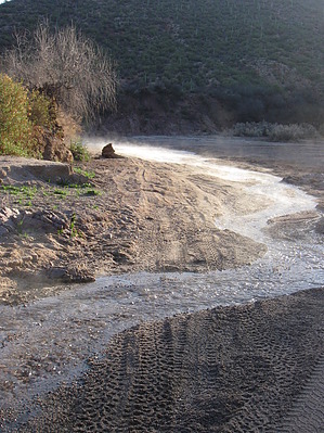
  GET Segment 5 overview GET Segment 5 overviewThe lone profile of tawny Antelope Peak presides over the first half of this enjoyable segment. Eastbound hikers have been eyeing this eroded volcanic cone for miles, and now finally get to inspect it at close range. The rolling, well-graded Arizona Trail hiking experience is more cohesive here than in Segment 4, with less road walking and more continuous treadway. Finally, though, the GET parts company with the southbound-trending Arizona Trail, slabbing east to begin its approach toward spectacular Aravaipa Canyon Wilderness (Segment 7). In the process, our route - a straightforward cross-country-via-wash experience now - passes near perennial Putnam Spring, by far this segment's best (and other than the San Pedro River, it's only reliable) water source. Here the GET returns to a saguaro-studded Lower Sonoran desert environment and threads a picturesque, red-walled box canyon on its way toward the lush, tree-lined oasis of the San Pedro River, which it then follows for a serene and contemplative mile. Extending over 100 miles from its source in Sonora, Mexico to the Gila River near Winkleman, the San Pedro is one of the Southwest's finest remaining examples of a low-desert riparian-riverine community. It is also a fragile and highly endangered ecosystem, due to long-term regional drought compounded by unsustainable agricultural use of groundwater along its length. A detailed, mile-by-mile description of this segment is available in the official GET guidebook. See https://simblissity.net/get-home.shtml
GET Segments 3 - 5, Superior to Mammoth Continuing southbound along the route of the Arizona Trail (and sometimes apart from it), the GET follows a combination of maintained singletrack and primitive foot trail into the little-known White Canyon Wilderness (BLM), a small but superlative landscape of remnant volcanic peaks and colorful ash-flow sedimentary cliffs. The Sonoran desert here is in fine form, with dense stands of saguaro cacti among a panoply of unique desert flora on display. After a challenging hike along rugged drainages and old mining roads south of the wilderness area, the route rejoins the Arizona Trail alongside the tree-lined banks of the Gila River where it seeks out a bridged crossing upstream. Beyond, the terrain gradually mellows and long-range views highlight the distant Sky Island range of the Santa Catalina Mountains near Tucson. Here the route continues to follow an adventurous web of singletrack trail and connecting dirt roads as it seeks out lone Antelope Peak, a low volcanic outlier of the Tortilla Mountains. Eventually, the GET and AZT part ways for good, as our route turns east along the wide sandy course of Putnam Wash in the company of dark basalt cliffs, then along the gentle San Pedro River in a rare desert riparian oasis, to reach AZ Hwy 77 ten miles north of the small village of Mammoth AZ. Check out the Official Route and Triplogs. Leave No Trace and +Add a Triplog after your hike to support this local community. One-Way Notice This hike is listed as One-Way. When hiking several trails on a single "hike", log it with a generic name that describes the hike. Then link the trails traveled, check out the example. | |||||||||||||||||||||||||||||||||||||||||||||||||||||||||||||||||||||||||||||||||||||||||||||||||||||||||||||||||||||||||||||||||||||||||||||||||||||||||||||||||||||||||||||||||||||||||||||||


