Route Editor

| Guide | ♦ | 12 Triplogs | 0 Topics |
details | drive | no permit | forecast | 🔥 route |
stats |
photos | triplogs | topics | location |
| 230 | 12 | 0 |
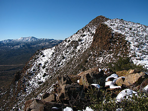
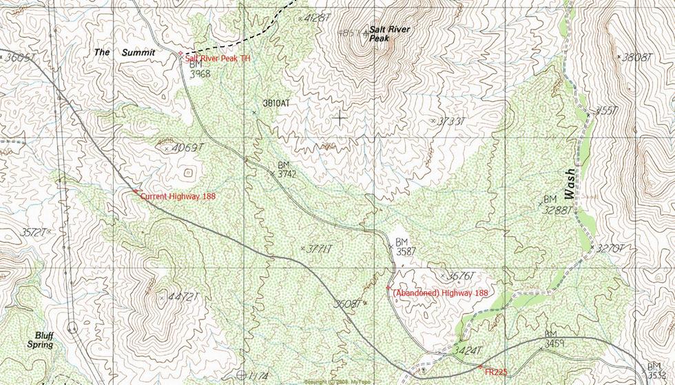
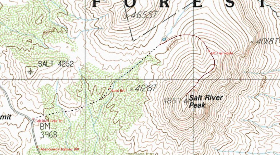
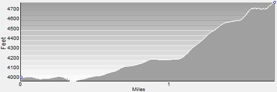
Mini Matterhorn by ssk44   Warning WarningSalt River Peak is a rugged cross-country route. Sufficient knowledge of topographical map reading and off-trail route finding is required for completing this hike. Bushwhacking is light. Overview Salt River Peak is a prominent benchmark summit located just outside of Globe within the Tonto National Forest and borders the far western edge of the Salt River Canyon Wilderness. Salt River Peak has rugged steep slopes on all but one side and has a dramatic postage-stamp summit. This is a cool short hike with manageable terrain and easy route finding. From the summit, you will be rewarded with epic 360-degree views of Four Peaks, Roosevelt Lake, Mazatzal Peak, Aztec Peak, Apache Peaks, and Signal Peak. Salt River Peak is a high point for the area and offers a unique perspective that no other nearby summit can offer. Surrounding summits are viewed in order from left to right, starting at Four Peaks directly northwest. It must be noted that Salt River Peak is very exposed with no shade and should only be hiked from late fall to early spring. The hike stats as posted within the description are "one-way" from the designated trailhead to the top of the 4,857 summit.
Reaching the summit of Salt River Peak is fairly straightforward. The initial segment of the hike follows an existing roadbed paralleling the north side of a fence line and heads to a saddle just off the northern slope of the mountain. This roadbed is not suitable for vehicles due to being washed out in multiple places. The road you will be following ends at a waterhole located just over the edge of the saddle. The remainder of the hike to the summit is all off-trail and follows the crest of a ridgeline to the top. Hike northeast from the waterhole to the visible skyline ridge. Once you're on this ridge, it's a no-brainer to the top. The route gets somewhat steep and boulder-strewn in places but never enough to feel exposed or sketchy. On the way up you will be rewarded with great views from the steep rugged bluffs that line the eastern slope of the mountain. The last half of the ridgeline is very defined with a couple of rolling saddles and a final steep and narrow push to the tiny rock pile summit. Pull up a boulder and soak in the views! See maps for further clarification of the route described in the text. Summary Salt River Peak is a must-do hike! It's a great short "summit fix" with a high payoff. The epic 360-degree views must be experienced in person! Don't forget to sign the summit registry located in a rock pile next to the benchmark. The entries on the registry are surprisingly extensive and go back as far as 1983. Hiking remote mountain summits truly gets in your blood. Once you've had a taste of it, you're hooked for life. Lunch and a view... You just can't beat it. Enjoy!
Check out the Official Route and Triplogs. Leave No Trace and +Add a Triplog after your hike to support this local community. | |||||||||||||||||||||||||||||||||||||||||||||||||||||||||||||||||||||||||||||||||||||||||||||||||||||||||||||||||||||||||||||||||||||||||||||||||||||||||||||||||||||||||||||||||||||||||||||||||||||