 Route Editor

| Guide | ♦ | 23 Triplogs | 2 Topics |
details | drive | permit | forecast | route |
stats |
photos | triplogs | topics | location |
| 166 | 23 | 2 |
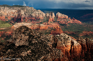
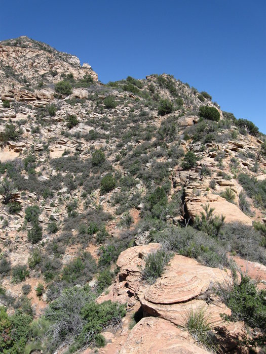
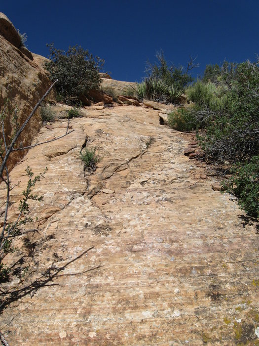
Climb Sedona's Centerpiece by hippiepunkpirate   The standard route to the summit of Capitol Butte is starting from Dry Creek Road and ascends via the southwest ridge. This route follows a rough, intermittent social trail that varies from class 2 to class 3 mountaineering. Class 2 generally describes hiking on talus/scree, which is prominent throughout most of the hike. Class 3 describes using your hands and feet to climb, and this hike has its fair share of these sections. The first quarter-mile of this route is class 1, standard hiking. The standard route to the summit of Capitol Butte is starting from Dry Creek Road and ascends via the southwest ridge. This route follows a rough, intermittent social trail that varies from class 2 to class 3 mountaineering. Class 2 generally describes hiking on talus/scree, which is prominent throughout most of the hike. Class 3 describes using your hands and feet to climb, and this hike has its fair share of these sections. The first quarter-mile of this route is class 1, standard hiking.Capitol Butte is notorious for causing climbers to get in over their heads, requiring expensive helicopter rescues. You don't want to be that guy or gal! Here are a few basic rules that you should follow to stay out of trouble. 1) Come prepared: water, snacks, first aid, ect. 2) Be aware of your surroundings at all times and use common sense. 3) Don't climb up anything you can't climb down. 4) Stay cool, calm and collected.
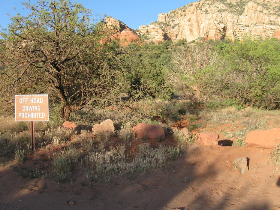
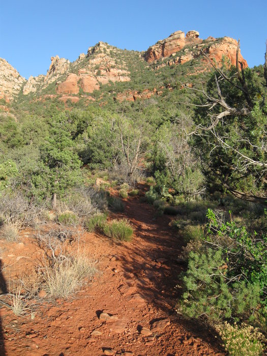
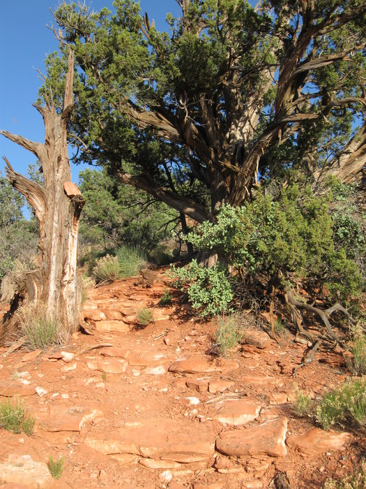
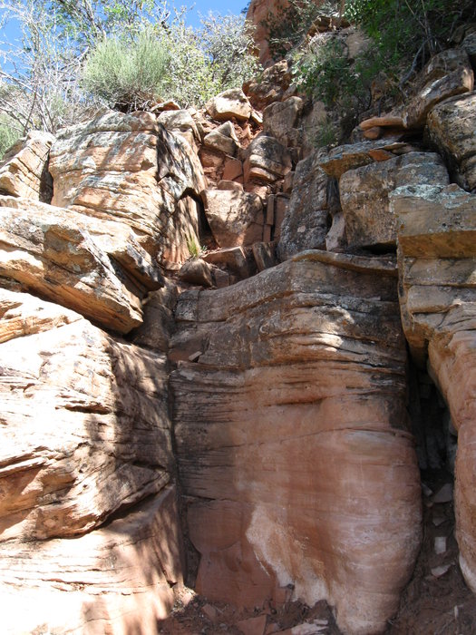
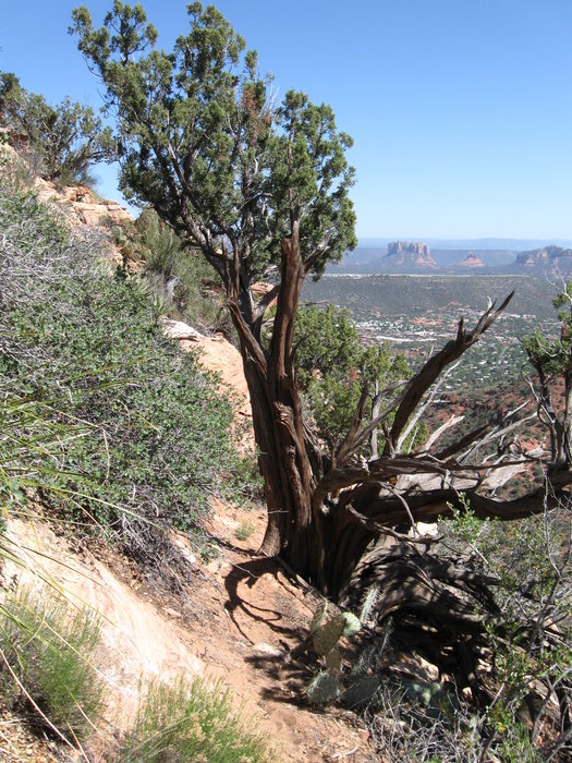
When I did this climb on May 6th, 2009, I met a man who had just summitted Capitol Butte for the ninth time in his life. That day was his 75th birthday. For the rest of the way up, I found myself contemplating moves with this thought: "If I was 75, would I be able to do this?" It definitely helped me re-evaluate the route in a couple of spots. As far as sun exposure, it is noteworthy that this route is most safely done in winter, or the morning during the hotter months. This route has a lot of sun exposure during the afternoon, although the afternoon light provides the best views of Wilson Mountain, Munds Mountain, Mitten Ridge, and most other monuments to the south and east. On an 85 degree day in May, I started at 2 PM, and I was hurting after the first half-mile. Hike From the "trailhead" at the Red Rock Pass dispensing station, you will notice two trails taking off. Take the upper one closer to the sign that says "Off Road Driving Prohibited." Don't get used to the smooth, easy-to-follow trail. At the first junction, turn left looking toward the butte. You will soon hit another junction at which you will turn left once again. This is where the fun starts! From here on out the trail is intermittent with loose soil and rocks, as well as overgrown vegetation. You will ascend two smaller slickrock benches (the Bell Rock Member and Fort Apache Member respectively). After the second bench, you will notice a large cliff face looming above. On my ascent, I remember losing the trail at some point along here. Just remember that the trail curves to the left around the cliff (along the north face). You will soon hit the first real class 3 section. It can be avoided by squeezing to the left, but I suggest climbing it. Some sections are a little more difficult later, so if you aren't comfortable with this, turn around NOW. Next, you will ascend a bench of Coconino Sandstone (tan-buff colored sandstone, compared to the red Schnebly Hill and Hermit Formations below). You will be climbing and hiking on Coconino for the rest of the ascent. The trail follows on or just below the ridge for a bit. Careful, the trail looks like it goes by this tree, but it doesn't. Instead, turn left and scramble up this slope. The trail gets steeper, many class 3 sections are encountered (most similar to the first, but longer). There are too many to describe in detail. Use common sense and remember that at no point should you have to move across areas with sheer drops. If you feel out of your comfort level, be safe and turn back. You'll know when you're near the top. Trails split off and criss-cross near the top, just be aware of the way you came. There are two big boulders, the easternmost one is the summit. Celebrate victory and feel free to sign the register! Care should be taken descending as the loose rocks and soil matched with the steep grade make it easy to slip and fall.
Check out the Official Route and Triplogs. Leave No Trace and +Add a Triplog after your hike & climb trip to support this local community. | ||||||||||||||||||||||||||||||||||||||||||||||||||||||||||||||||||||||||||||||||||||||||||||||||||||||||||||||||||||||


