username
X
password
register
for free!
help
   🔥

David Miller Trail, AZ

Guide 19 Triplogs  0 Topics
  3.9 of 5  
Fav
Wish
2
details
drive
permit
forecast
🔥
route  
stats
photos
triplogs
topics
location
127 19 0
Statistics
tap row or icons for details
Difficulty 2.5 of 5
Route Finding 1 of 5
Distance One Way 0.95 miles
Trailhead Elevation 4,679 feet
Elevation Gain 571 feet
Accumulated Gain 571 feet
Kokopelli Seeds 2.85
 Interest Seasonal Creek
 Backpack Possible - Not Popular
feature photo
Photos Viewed All MineFollowing
Will recalculate on button tap!
17  2021-04-10
Bear Sign / Secret Loop
GrangerGuy
6  2020-07-04
Bear Sign / Secret Loop
Lost
25  2019-09-28 roaminghiker
7  2018-11-03
Brins Mesa Trail #119
Daytripper
8  2018-04-30
Bear Sign / Secret Loop
fricknaley
15  2018-02-17
Bear Sign / Secret Loop
chumley
11  2017-11-25
Bear Sign / Secret Loop
Nightstalker
3  2017-08-23
Bear Sign / Secret Loop
JuanJaimeiii
Page 1,  2
Author
author avatar Guides 73
Routes 176
Photos 10,174
Trips 2,324 map ( 14,158 miles )
Age 46 Male Gender
Location
Associated Areas
list map done
Sedona Region
Historical Weather
Trailhead Forecast
Radar Map
Expand Map
Preferred Apr, Oct, Mar, Nov → 10 AM
Seasons   ALL
Sun  6:02am - 6:50pm
Official Route & 1 Rt
 
11 Alternative
 
Historic Fire Perimeteracres
🔥 2014 Slide Fire21.7k


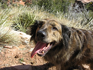
Short Connector, or Great Views before the Canyon
by Jim

Overview
This is a short trail that can be used to make a spur to a small high point from which awe-inspiring views can be had, or it can be used as part of several trails to make a loop in the upper Dry Creek area. It is usable year-round, and water is plentiful when the snow is melting.


Hike
The David Miller Trail is reached fastest from the Secret Canyon Trailhead. Numerous creek crossings might deter some if they are running high with water, but they are dry most of the year. The water is great for dogs if you bring yours along. Start at the trailhead and begin hiking the Secret Canyon Trail. After 2/3 of a mile, you will pass the H.S. Canyon Trail. Continue on the Secret Canyon Trail, and at approximately 1.75 miles from the trailhead, you will come to the junction with the David Miller Trail. This is right about the location the Secret Canyon Trail turns to go into the canyon.
remove free decal offer
Once on the David Miller Trail, the hike becomes shady and runs along a small seasonal creek. You'll cross it a few times and begin to climb gently at first. You encounter some ponderosa pine and douglas fir, but it will mostly be classic Sedona vegetation. After a half-mile, you'll begin to climb. Soon you will reach a series of reasonably steep sandstone switchbacks. At this point, the views start to open up. Not too much further up the trail, you will reach a nice viewpoint that provides excellent views of the region. Continuing, the trail gains a little more elevation before it tops out and descends quickly into the canyon. Near this summit, there is a fine outcropping of Coconino Sandstone, which makes a great place to walk over to and get some unobstructed views of the Rim above you. You descend into a small valley from the trail's summit, where you will meet the Bear Sign Trail. The valley is filled with dense pine and fir and would be a fine hike to reach in summer after climbing the hot south slope of the David Miller. There is also a seasonal stream in the valley. Unless making the loop, return the way you came.

Loop Option
The David Miller Trail is short but worthy of a hike in its own right. However, if seeking a longer hike, or a loop hike, it can be incorporated into a loop using the Secret Canyon Trail, the David Miller Trail, the Bear Sign trail, the Dry Creek Trail, and a short section of the Dry Creek Road (FR 152) south of the Vultee Arch Trailhead. Camping is an option in the upper reaches of the Bear Sign "valley." With the snowmelt in late winter and early spring, it could be a peaceful secluded spot to spend the night in Sedona.

2010-03-06 Jim
  • Wilderness Map
    area related
    Wilderness Map
  • wilderness related
  • 2021 Verde Valley Trails
    region related
    2021 Verde Valley Trails
  • 2021 Verde Valley Area
    region related
    2021 Verde Valley Area
  • 2021 Sedona Trails Map
    region related
    2021 Sedona Trails Map


Check out the Official Route and Triplogs.
Leave No Trace and +Add a Triplog after your hike to support this local community.

One-Way Notice
This hike is listed as One-Way.

When hiking several trails on a single "hike", log it with a generic name that describes the hike. Then link the trails traveled, check out the example.
WARNING! Hiking and outdoor related sports can be dangerous. Be responsible and prepare for the trip. Study the area you are entering and plan accordingly. Dress for the current and unexpected weather changes. Take plenty of water. Never go alone. Make an itinerary with your plan(s), route(s), destination(s) and expected return time. Give your itinerary to trusted family and/or friends.

 Permit $$
Red Rock Pass - may or may not be required. Go to Red Rock Pass then check "When is a Red Rock Pass Required?". If you have questions contact the Coconino forest service.

Red Rock - Secret Mountain Wilderness
see map for camping restrictions


 Directions
or
 Road
FR / Jeep Road - Car possible when dry

To hike
From the junction of Routes 89A and 179, take 89A west 3.2 miles to Dry Creek Road on the right. Go 1.9 miles to FS 152 on the right. Take this unpaved road 3.4 miles to trailhead parking on the left. Forest Road 152 is normally passable for any car but should be avoided in wet weather. Though some cars would make the 3.4 miles in on FS 152, I would not be able to get my Honda Civic there, and I recommend a connection with another access trail or a hike up the road.
page created by Jim on Mar 06 2010 12:04 pm
 90+° 8am - 6pm kills
helpcorrectionissue

end of page marker