 Route Editor

| Guide | ♦ | 11 Triplogs | 0 Topics |
details | drive | no permit | forecast | 🔥 route |
stats |
photos | triplogs | topics | location |
| 168 | 11 | 0 |
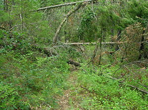
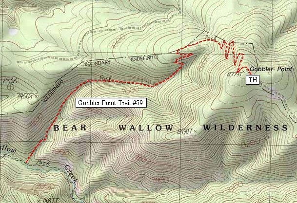
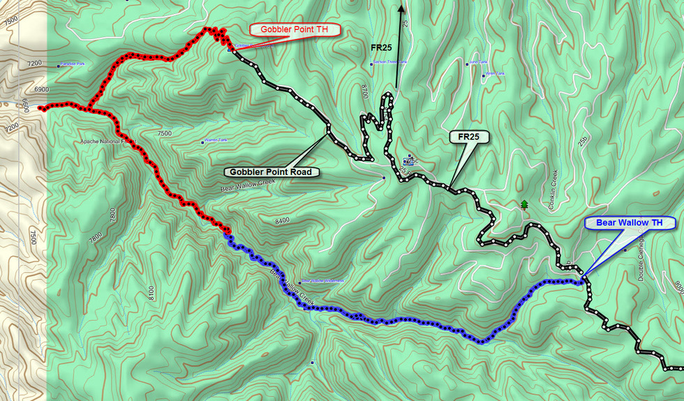
Black River Views by HAZ_Hikebot  Good views of the Black River drainage and San Carlos Indian Reservation provide a scenic send-off for this trail into the Bear Wallow Wilderness. From the trailhead, views stretch to Mount Graham in the Pinaleno Range 80 miles to the southwest. This striking panorama accompanies you a good portion of the way of down the steep switchbacks that begins the trail's descent into a side drainage of Bear Wallow Creek and eventually to the canyon floor. Gobbler Point is the steepest trail leading into the wilderness. It also provides the shortest route to the creek's downstream reaches, which could be important to those interested in fishing the stream's pools and riffles for the stocked population of native Apache Trout. Good views of the Black River drainage and San Carlos Indian Reservation provide a scenic send-off for this trail into the Bear Wallow Wilderness. From the trailhead, views stretch to Mount Graham in the Pinaleno Range 80 miles to the southwest. This striking panorama accompanies you a good portion of the way of down the steep switchbacks that begins the trail's descent into a side drainage of Bear Wallow Creek and eventually to the canyon floor. Gobbler Point is the steepest trail leading into the wilderness. It also provides the shortest route to the creek's downstream reaches, which could be important to those interested in fishing the stream's pools and riffles for the stocked population of native Apache Trout.In addition to panoramic views, a mixed stand of conifers, ponderosa pine, and aspen provide a scenic setting for the trail's upper reaches. Those tall upland species gradually give way to clumps of Gambel oak, red-osier dogwood, and bracken fern as the trail loses altitude. At the junction with Bear Wallow Trail on the canyon floor, the trail is set in a park-like community of ponderosa pines and canyon hardwoods, including Arizona ash, alder, and box elder. A sprinkling of wildflowers usually adds a splash of color.
No motorized or mechanized vehicles (including mountain bikes) are permitted in Wilderness. The trail is steep, exposed to direct sun, and drops 2,100 feet in 2.7 miles. Be sure to carry enough water. A special use permit from the tribe is required for entry onto the San Carlos Apache Indian Reservation. Trail Log: 0.0 The trail heads west from the parking lot at the end of Gobbler Point Road (Forest Road 8154) 0.9 Drop into the drainage and continue the descent to Bear Wallow Creek and Trail. 2.7 Junction with Bear Wallow Trail #63. USGS Maps: Hoodoo Knoll
Check out the Official Route and Triplogs. Leave No Trace and +Add a Triplog after your hike to support this local community. One-Way Notice This hike is listed as One-Way. When hiking several trails on a single "hike", log it with a generic name that describes the hike. Then link the trails traveled, check out the example. | |||||||||||||||||||||||||||||||||||||||||||||||||||||||||||||||||||||||||||||||||||||||||||||||||||||||||||||||||||||||||||||||||||||||||||||||||||||||||||||||||||||||||||||||||||||||||||||||||||||||||||


