 Route Editor

| Guide | ♦ | 22 Triplogs | 0 Topics |
details | drive | no permit | forecast | 🔥 route |
stats |
photos | triplogs | topics | location |
| 0 | 22 | 0 |
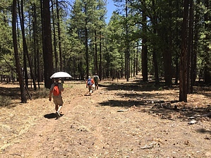
as in patty by HAZ_Hikebot   Cow Flat Trail is sufficiently long and passes through so many different areas known by several names. Alternately it is referred to as the Bear Valley, Government Mesa, and Ladron Springs Trail. It leads to or through each of those different forest locations. That portion of the trail, which lies within the boundary of the Alpine District, winds along the top of the Mogollon Rim through mature park-like stands of ponderosa pine alternating with pinyon-juniper woodlands on the high plateaus of Cow and Campbell Flats. This stretch of the trail connects with several other backcountry trails that offer almost comprehensive access to this diverse area. Cow Flat Trail is sufficiently long and passes through so many different areas known by several names. Alternately it is referred to as the Bear Valley, Government Mesa, and Ladron Springs Trail. It leads to or through each of those different forest locations. That portion of the trail, which lies within the boundary of the Alpine District, winds along the top of the Mogollon Rim through mature park-like stands of ponderosa pine alternating with pinyon-juniper woodlands on the high plateaus of Cow and Campbell Flats. This stretch of the trail connects with several other backcountry trails that offer almost comprehensive access to this diverse area.The Cow Flat portion of Trail #55 is well defined and easy to follow. As the trail traverses Bear Valley and crosses Government Mesa, it becomes more difficult to follow. While you're keeping an eye out for blazes and rock cairns, you might notice the remains of an old wagon and a few outbuildings that bear testament to the fact that this valley was farmed during the turn of the century. After the trail leaves Bear Valley, it's as rough and tough as three cowboys who once lived here. Pappy (who lived in a cave), Smokey (who loved his mules), and Buster (a cowboy stonemason) added a bit of their spirit to this wild area. You may find yourself calling on them to help you find your way.
Below Ladron Springs, the trail hugs a bedrock slope across a steep chute where pack animals once needed to be unpacked to cross. One unfortunate animal fell to its death here in 1980. In 1983 a forest crew received authorization to take motorized equipment into the primitive area to drill and blast a wider passage to the great appreciation of those using this trail on horseback. Ladron Springs emerges at the base of a large walnut tree as a constant and powerful water source. Several small waterfalls mark its drainage between the spring and trail's end at the Blue River. Notes: No mechanized vehicles (including mountain bikes) permitted in Primitive Area. Trail Log: 0.0 Junction with Bonanza Bill Trail #23 at Bonanza Flat. 0.7 Junction with S Canyon Trail #53. 1.2 Junction with Franz Spring #43. 1.4 Junction with Lanphier Trail #52. 1.6 Junction with a shortcut trail to Franz Spring. 3.6 Junction with WS Lake Trail #54. 5.2 Junction with Little Blue Trail #41 at the corral at the lower end of Bear Valley. Elevation 6,600 feet. 5.3 Bear Valley Cabin. 5.4 Trail heads west out of Bear Valley. 6.4 High point on the trail at the junction with an unmaintained trail to Little Blue Creek. 8.9 Rock cairn marks the unmaintained trail to the south to Winter Cabin. 9.9 Auger Canyon, another unmaintained trail, leads from here to Winter Cabin. 11.1 Sycamore Canyon at the old corral. 11.6 Ladron Spring. 12.1 Blue River. USGS Maps: Bear Mountain, Dutch Blue, Alma Mesa Check out the Official Route and Triplogs. Leave No Trace and +Add a Triplog after your hike to support this local community. One-Way Notice This hike is listed as One-Way. When hiking several trails on a single "hike", log it with a generic name that describes the hike. Then link the trails traveled, check out the example. | |||||||||||||||||||||||||||||||||||||||||||||||||||||||||||||||||||||||||||||||||||||||||||||||||||||||||||||||||||||||||||||||||||||||||||||||||||||||||||||||||||||||||||||||||||||||||||||||||||||||||||||||||||||||||||||


