 Route Editor

| Guide | ♦ | 10 Triplogs | 0 Topics |
details | drive | no permit | forecast | 🔥 route |
stats |
photos | triplogs | topics | location |
| 207 | 10 | 0 |
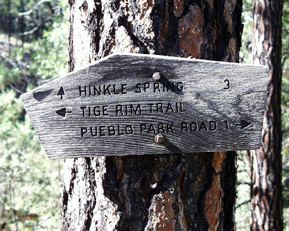
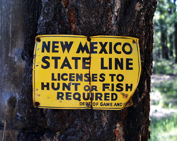
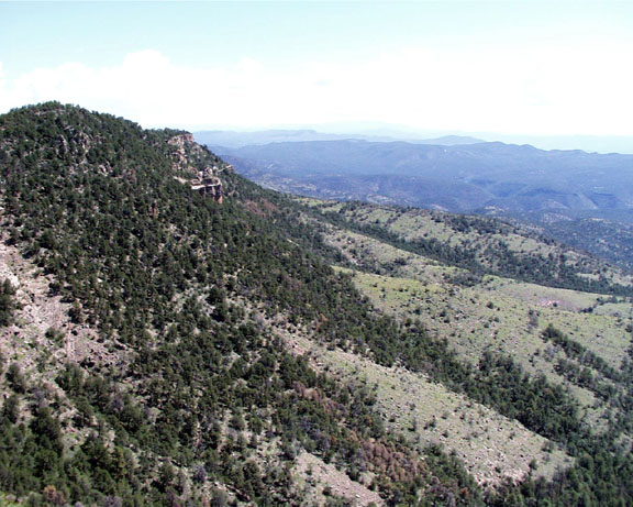
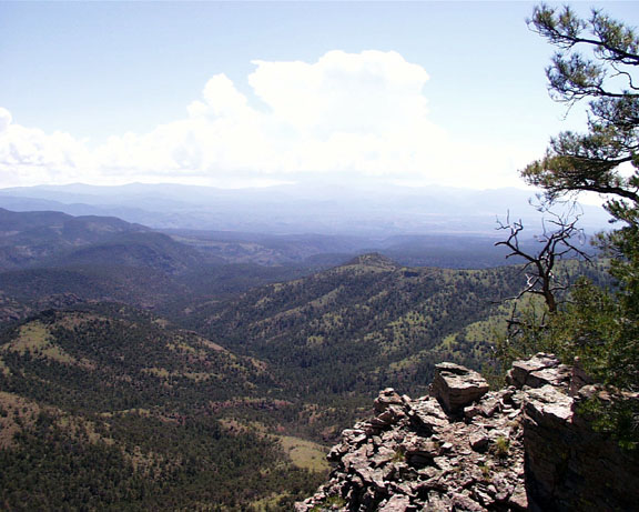
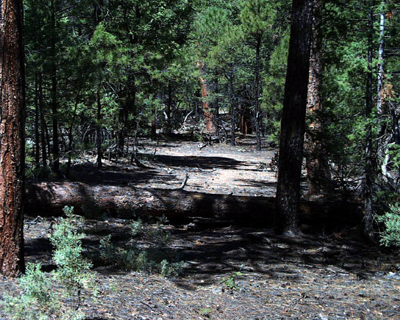
AZ to New Mexico in a day by conform6073  Although Tige Rim Trail lies almost entirely in New Mexico, the only access is from Arizona, and that fact should qualify it as an Arizona hike. It begins about 1 mile down Bonanza Bill Trail on the northern edge of the Blue Range Primitive Area. At a fork there, Bonanza Bill continues to the right, and Tige Rim takes off to the left. Almost immediately it passes through a gate and enters New Mexico. For the next 1.75 miles the trail lies atop an old road and proceeds pretty much straight southeast, rising steadily. Views in this area are restricted by dense growth of mainly small trees on either side. Eventually the route veers south, leaving the road bed and tracing the Rim itself. Brief glimpses of views east off the Rim and west back toward the Blue high country begin to appear. About 3 miles from its beginning, the trail tops a high, clear point on the Rim's very edge, granting a panoramic vista to the north and east of the San Francisco river valley 1,500 feet below and the Mogollon mountains beyond. The way then descends into and crosses a draw that shelters some good sized ponderosa pines and rises to a second, slightly higher point with spectacular views east and south toward Whitewater Baldy and the rest of the Gila Wilderness. From here the trail turns west and wanders a mile and a half through mixed forest to rejoin Bonanza Bill 3.5 miles south of where the two separated. Although Tige Rim Trail lies almost entirely in New Mexico, the only access is from Arizona, and that fact should qualify it as an Arizona hike. It begins about 1 mile down Bonanza Bill Trail on the northern edge of the Blue Range Primitive Area. At a fork there, Bonanza Bill continues to the right, and Tige Rim takes off to the left. Almost immediately it passes through a gate and enters New Mexico. For the next 1.75 miles the trail lies atop an old road and proceeds pretty much straight southeast, rising steadily. Views in this area are restricted by dense growth of mainly small trees on either side. Eventually the route veers south, leaving the road bed and tracing the Rim itself. Brief glimpses of views east off the Rim and west back toward the Blue high country begin to appear. About 3 miles from its beginning, the trail tops a high, clear point on the Rim's very edge, granting a panoramic vista to the north and east of the San Francisco river valley 1,500 feet below and the Mogollon mountains beyond. The way then descends into and crosses a draw that shelters some good sized ponderosa pines and rises to a second, slightly higher point with spectacular views east and south toward Whitewater Baldy and the rest of the Gila Wilderness. From here the trail turns west and wanders a mile and a half through mixed forest to rejoin Bonanza Bill 3.5 miles south of where the two separated.Here the hiker has several options: (1) Follow Bonanza Bill north back to trailhead - 4.5 miles; (2) Follow Bonanza Bill north 1 mile to Hinkle Spring Trail, then down the latter 4.5 miles to Blue river; (3) go south 1.8 miles to S Canyon Trail or 2.3 miles to Lanphier Trail and proceed 5.8 or 5.6 miles, respectively, to the trailhead at Blue Camp. All choices except the first require a shuttle, and shuttling by mountain bike is not recommended.
Gate Policy: If a gate is closed upon arrival, leave it closed after you go through. If it is open, leave it open. Leaving a closed gate open may put cattle in danger. Closing an open gate may cut them off from water. Please be respectful, leave gates as found. The exception is signage on the gate directing you otherwise. Apache - Sitgreaves FS Details The Tige Rim Trail provides a "scenic route" alternative to the more direct Bonanza Bill Trail into the eastern reaches of the Blue Range. Nearly continuous long range vistas serve as its main attraction. The Tige Rim Trail keeps to the high ground crossing from Arizona into New Mexico and then back again as it wanders across this canyon carved landscape. The trail branches off the Bonanza Bill Trail about a mile from the Pueblo Park Trailhead and sets off on a winding route, skirting first Pueblo and Tige Canyon to the east, then Steeple Canyon to the west. It's 1.3 miles farther to the same point if you take the Tige Canyon Trail rather than Bonanza Bill, but if scenery is what you're after, it's well worth the added steps. This trail makes a good day hike when combined with the Bonanza Bill Trail. The 8.7 mile loop provides a good sampling of what the eastern reaches of the Blue have to offer. Trailside vegetation starts out as ponderosa pine mixed with Gambel oak and mature juniper near the trailhead. The overstory varies with elevation and exposure through a broad range of trees and shrubs, from scrub oak and pinyon-juniper communities on the steep slopes and cliffs to the east, to ponderosa pine and mixed conifers such as white fir and Douglas-fir in Steeple Creek Basin. Tige Canyon and Bonanza Bill Trails join about 1.3 miles south of Hinkle Spring, virtually on the Arizona/New Mexico line. Notes: No mechanized vehicles (including mountain bikes) permitted in Primitive Area There are no water sources on this trail Trail Log: 0.0 Northern junction with Bonanza Bill Trail, about a half mile from the trailhead at Pueblo Park Road, Forest Road 232 0.1 Gate in fence 1.0 Gate in fence; trail enters a pine and juniper flat 3.0 Good views of the upper reaches of Tige Canyon for the next mile 5.0 Southern junction with Bonanza Bill Trail at a fence gate USGS Maps: Blue SE Check out the Official Route and Triplogs. Leave No Trace and +Add a Triplog after your hike to support this local community. One-Way Notice This hike is listed as One-Way. When hiking several trails on a single "hike", log it with a generic name that describes the hike. Then link the trails traveled, check out the example. | |||||||||||||||||||||||||||||||||||||||||||||||||||||||||||||||||||||||||||||||||||||||||||||||||||||||||||||||||||||||||||||||||||||||||||||||||||||||||||||||||||||||||||||||||||||||||||||||||||||||||||||||||||||


