Oldham Trail begins in Buffalo Park, Flagstaff's urban forest park, and climbs gradually up the south slope of Mt. Elden, an extinct volcano. The trail gets its name from Oldham Park, an open area near Elden's summit. From that high perspective, you'll get a bird's eye view of Flagstaff and the surrounding area, including mountains, deserts, and canyons as much as a hundred miles away. Some prominent features that are easily visible are Oak Creek Canyon, Sunset Crater, and the Painted Desert.
Along the lower reaches of the trail, you'll encounter boulder fields and cliffs where there are hidden crevices to explore and rocky nooks that make great places to picnic. As you climb higher, the trail takes you from a ponderosa pine forest into groves of aspen and mixed conifer stands of spruce, fir, and pine.
In Oldham Park, you'll see evidence of a catastrophic burn that occurred in 1977. Although the area affected by this colossal wildfire still looks barren from Flagstaff, up close, you can see how nature is healing.
Near Elden Summit, Oldham Trail joins the Sunset Trail which leads north across the top of Elden to Schultz Pass and south to the Elden Lookout Trail and east Flagstaff.
When hiking several trails on a single "hike", log it with a generic name that describes the hike. Then link the trails traveled, check out the example.
WARNING! Hiking and outdoor related sports can be dangerous. Be responsible and prepare for the trip. Study the area you are entering and plan accordingly. Dress for the current and unexpected weather changes. Take plenty of water. Never go alone. Make an itinerary with your plan(s), route(s), destination(s) and expected return time. Give your itinerary to trusted family and/or friends.
Permit $$
None
Directions
Road
Paved - Car Okay
To hike The Buffalo Park parking lot is located on Cedar Street in north-central Flagstaff. Another access point is on FR 557, the Mt. Elden Road, off US 180 north.
 Route Editor

 Oldham Trail begins in Buffalo Park, Flagstaff's urban forest park, and climbs gradually up the south slope of Mt. Elden, an extinct volcano. The trail gets its name from Oldham Park, an open area near Elden's summit. From that high perspective, you'll get a bird's eye view of Flagstaff and the surrounding area, including mountains, deserts, and canyons as much as a hundred miles away. Some prominent features that are easily visible are Oak Creek Canyon, Sunset Crater, and the Painted Desert.
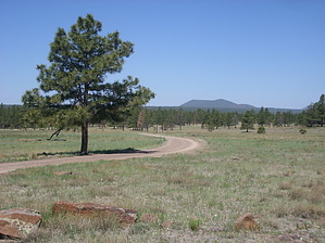


