 Route Editor

| Guide | ♦ | 16 Triplogs | 2 Topics |
details | drive | no permit | forecast | 🔥 route |
stats |
photos | triplogs | topics | location |
| 3 | 16 | 2 |
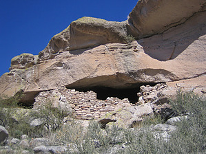
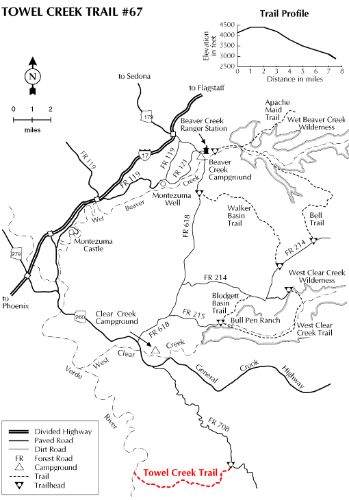
Grazin' Beauty by HAZ_Hikebot   This trail is unique among those on the Coconino National Forest. It leads through an area of picturesque buttes and low bluffy mountains that is quite different from that along any other trail on the forest. It is also one of the few trails on the Coconino that leads to the Verde River, a great place to camp out or cool your feet before starting back to the trailhead. This trail is unique among those on the Coconino National Forest. It leads through an area of picturesque buttes and low bluffy mountains that is quite different from that along any other trail on the forest. It is also one of the few trails on the Coconino that leads to the Verde River, a great place to camp out or cool your feet before starting back to the trailhead.The main vegetation type in this rugged country is high chaparral. It consists primarily of manzanita, scrub oak, and cliffrose. There are hackberries, for which nearby Hackberry Mountain is named. Cottonwoods, sycamores, and willows cluster near the few seeps and springs, while stands of pinyons and junipers cling to the higher elevations.
About 3 miles from the trailhead, a short side-hike leads to Towel Spring. 3.5 miles further along, you'll see an old line shack that cowboys still use. From here, it's two more miles to the Verde River and its cool waters.
Check out the Official Route and Triplogs. Leave No Trace and +Add a Triplog after your hike to support this local community. One-Way Notice This hike is listed as One-Way. When hiking several trails on a single "hike", log it with a generic name that describes the hike. Then link the trails traveled, check out the example. | |||||||||||||||||||||||||||||||||||||||||||||||||||||||||||||||||||||||||||||||||||||||||||||||||||||||||||||||||||||||||||||||||||||||||||||||||||||||||||||||||||||||||||||||||||||||||||


