 Route Editor

| Guide | 0 Triplogs | 0 Topics |
details | drive | no permit | forecast | map |
stats |
photos | triplogs | topics | location |
| 7 | 0 | 0 |
  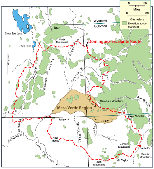 Fathers Francisco Dominguez and Silvestre Escalante, Spanish priests, may have been the first Europeans to see the Arizona Strip on their expedition in 1776. On foot, they traveled from Santa Fe, New Mexico through western Colorado, to Spanish Fork, Utah, and then down through northern Arizona back to Santa Fe. Others crossed the Strip along the Old Spanish Trail during the 1830s and 1840s. Fathers Francisco Dominguez and Silvestre Escalante, Spanish priests, may have been the first Europeans to see the Arizona Strip on their expedition in 1776. On foot, they traveled from Santa Fe, New Mexico through western Colorado, to Spanish Fork, Utah, and then down through northern Arizona back to Santa Fe. Others crossed the Strip along the Old Spanish Trail during the 1830s and 1840s.The Dominguez - Escalante Expedition Site: Fathers Francisco Dominguez and Silvestre Escalante, Spanish priests, may have been the first Europeans to see the Arizona Strip on their expedition in 1776. On foot, they traveled from Santa Fe, New Mexico through western Colorado, to Spanish Fork, Utah, and then down through northern Arizona back to Santa Fe. Others crossed the Strip along the Old Spanish Trail during the 1830s and 1840s.
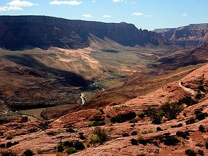
Mining activities, timber cutting, and settlement by farmers and ranchers began by the 1870s. Settlements founded by these pioneers lasted long enough for a post office and general store to be built at Wolfhole and one-room schoolhouses at Little Tanks and Mount Trumbull. In the days of horse-drawn wagons, trips to town (St. George, Utah) from these communities took more than one day each way. Travelers would store feed for their stock on flat-topped boulders along the route. Later, the Civilian Conservation Corps created or improved many of the access roads and other structures. As the availability and use of motorized vehicles increased, populations of the little settlements dwindled. The communities of Mt. Trumbull, Wolf Hole, and Little Tanks are now ghost towns. Traveling across the Strip today, it is not so difficult to imagine the earlier times and modes of transportation: horse, wagon, and Model T. Place names like Poverty Mountain, Hungry Valley, Last Chance Spring, Death Valley, and Tombstone Canyon still attest to the rough life of the pioneers. Leave No Trace and +Add a Triplog after your hike to support this local community. One-Way Notice This hike is listed as One-Way. When hiking several trails on a single "hike", log it with a generic name that describes the hike. Then link the trails traveled, check out the example. | ||||||||||||||||||||||||||||||||||||||||||||||||||||||||||||||


