 Route Editor

| Guide | ♦ | 22 Triplogs | 1 Topic |
details | drive | no permit | forecast | 🔥 route |
stats |
photos | triplogs | topic | location |
| 320 | 22 | 1 |
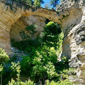
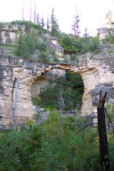
short but scenic by PrestonSands   Note NotePlease note that the page data is correct for a one-way trek from the WNW trailhead to the ESE trailhead. The description below describes starting from the ESE, adjust data accordingly to your adventure when posting triplogs. This is a rather short trail, but it is very pretty. The trail crosses Willow Canyon (Willow Valley on the topo map), which flows into West Clear Creek about five miles downstream.
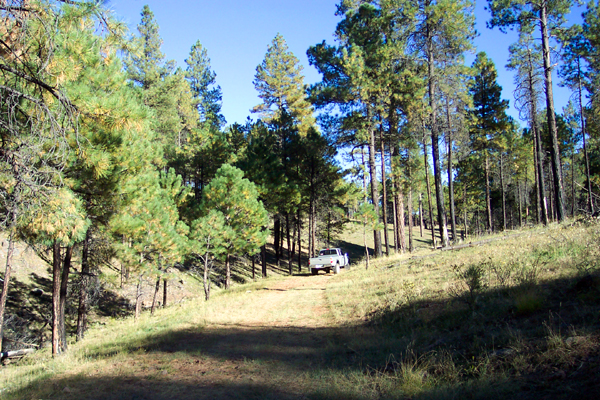
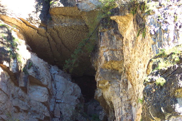
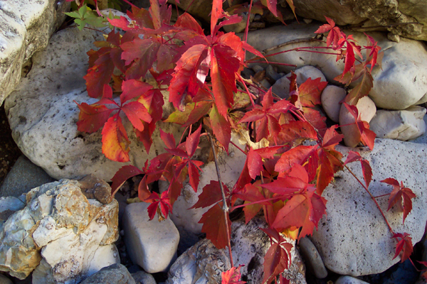
We lingered in the bottom of Willow Canyon for a while and hiked downstream maybe a quarter-mile. A short way down the canyon we saw a cave or alcove about a hundred feet up the cliff on the south canyon wall. It would have made a nice spot for a cliff dwelling. It was late September when we did this hike, and there was some fall color in the canyon, mostly golden box-elder trees. We also saw a bright red Virginia creeper vine. From where the trail reaches the bottom of the canyon, it continues upstream past the campsite and arch and climbs the north canyon wall, a short distance east of the arch. From there it was about a mile to forest service road 9366m, where the trail ended. We returned the way we came in. Gate Policy: If a gate is closed upon arrival, leave it closed after you go through. If it is open, leave it open. Leaving a closed gate open may put cattle in danger. Closing an open gate may cut them off from water. Please be respectful, leave gates as found. The exception is signage on the gate directing you otherwise. Coconino FS Details The trail starts at the end of FR 122A in a parklike setting of mature ponderosa pine. The trail heads northwest following the west side of a small drainage before descending into Willow Valley. Vegetation found along this stretch of trail includes ponderosa pine, locust, and Gamble oak. Once in the drainage of Willow Valley, the vegetation consists of more riparian species, including poison ivy. Learn to identify this three-leaved plant. Other riparian plants in the drainage include wild grape and willow. The rugged canyon of Willow Valley provides the required habitat for many species of wildlife, including the reclusive black bear. Look for signs of black bear activity such as torn-apart logs and overturned rocks. The trail climbs gradually out of the canyon through an area of ponderosa pine and follows along the south side of a fence line to the trailhead on FR 9366M. Watch for the rock cairns that mark the trail through this stretch.
Check out the Official Route and Triplogs. Leave No Trace and +Add a Triplog after your hike to support this local community. One-Way Notice This hike is listed as One-Way. When hiking several trails on a single "hike", log it with a generic name that describes the hike. Then link the trails traveled, check out the example. | ||||||||||||||||||||||||||||||||||||||||||||||||||||||||||||||||||||||||||||||||||||||||||||||||||||||||||||||||||||||||||||||||||||||||||||||||||||||||||||||||||||||||||||||||||||||||||||||||||


