 Route Editor

| Guide | ♦ | 1 Triplog | 0 Topics |
details | drive | permit | forecast | route |
stats |
photos | triplog | topics | location |
| 16 | 1 | 0 |
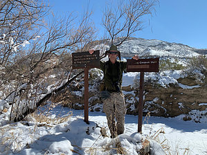
hike to a distant gap by markthurman53 The Rio Grande River comes down out of Colorado, heads south through New Mexico, and passes through El Paso Texas where it now becomes the border between the United States and Mexico. The river flows 1254 miles in a southeast direction toward the Gulf of Mexico, but before getting there, it turns to the North East, creating a momentary bend in the river; this Is Big Bend National Park. The mountains in this park are a continuation of a mountain range in Mexico that will continue into the US through Guadalupe National Park and New Mexico. The highest point in this park is Emory Peak, at 7800 feet. This park is probably one of the remotest parks in the contiguous United States. Despite being in the middle of nowhere, it has a lot to offer in hiking, camping, and general sightseeing. DOG CANYON
When I was driving into the park from the north entrance, I spotted an intriguing gap in the Santiago Mountains to the east, just a short way into the park. I later found out there was a short 2.5-mile hike to that gap called Dog Canyon. Dog canyon is a gap in the low lying desert mountains that drains the valley west of the Santiago Mountains to a stream east of the mountains that will eventually drain into the Rio Grande via Maravillas Creek. This trail is an easy walk across the desert flats till it eventually follows along dog creek to the gap. This gap is about 50 yards across with rock walls that rise steeply on each side and maybe a quarter-mile long. Interesting hike if you have a couple of hours before leaving or entering the park. Description The Dog Canyon trailhead is about 5 miles in, along the park road on the east side. The trailhead is marked with room for a couple of cars to park. There appears to be a trail that heads east across the flats with cairns every so often. I say there appears to be a trail because when I hiked the trail, there were about 4 to 6 inches of snow, and I followed someone else’s tracks. I did notice rock cairns along the way, and where I did see a trail, it seemed to be well worn. The trail follows along the desert flats for about 1.4 miles before dropping into Dog Creek. It then follows the creek for the remainder. From the desert flats, you can see the Rosillo Mountains to the southwest, which at this time were white with snow. Dagger Mountain and Sierra Del Caballo Muerto Mountains to the south, and Santiago Mountains straight ahead. The trail follows the wash for about 0.4 miles. When the cliffs on the south side of the canyon start getting higher, a little further on, you enter the gap with nothing exciting happening. I was expecting more of a rocky wash with some rock drop-offs, but instead, the wash continues through the gap along a smooth sandy wash. The cliffs on either side of the wash are quite impressive, though. Once through the gap, we continued along the wash to near the park boundary to make this a 5-mile round trip hike. This was a very cool hike, probably made more interesting because of the snow but still worth seeing if you are on your way out of the park and have a couple of hours to spare. I would not recommend this hike on a hot day or after heavy rain because it would be quite muddy. Probably best if done in late fall to early spring. Check out the Official Route and Triplog. Leave No Trace and +Add a Triplog after your hike to support this local community. One-Way Notice This hike is listed as One-Way. When hiking several trails on a single "hike", log it with a generic name that describes the hike. Then link the trails traveled, check out the example. | ||||||||||||||||||||||||||||||||||||||||||||||||||||||||||||||||||||||||||||||||||||||


