username
X
password
register
for free!
help
 This is likely a great time to hike this trail!  Check out "Preferred" months below, keep in mind this is an estimate.
  

Elk Meadows Trail #645, OR

Guide 4 Triplogs  0 Topics
  4 of 5 
Fav
Wish
1
details
drive
permit
forecast
route  
stats
photos
triplogs
topics
location
52 4 0
Statistics
tap icons for details
Difficulty 2.5 of 5
Distance One Way 10 miles
Trailhead Elevation 4,253 feet
Elevation Gain -1,374 feet
Accumulated Gain 1,201 feet
Kokopelli Seeds 14
unreported if dogs are allowed
editedit > ops > dogs to adjust
feature photo
Photos Viewed All MineFollowing
Inaugural Calculation on Button Tap!
6  2021-09-14 keepmoving
4  2020-10-26 keepmoving
33  2019-07-04
Gnarl Ridge
Lucyan
9  2018-09-06 keepmoving
Author
author avatar Guides 16,883
Routes 17,298
Photos 24
Trips 1 map ( 6 miles )
Age 26 Male Gender
Location HAZ, TrailDEX
Associated Areas
list map done
North Central Region
Historical Weather
Trailhead Forecast
Radar Map
Expand Map
Preferred Aug, Jul, Sep, Jun
Sun  4:22am - 7:46pm
Official Route
 
0 Alternative
 
 Water


 Likely In-Season!
This trail enters the Mount Hood Wilderness on the east side of Mount Hood. The trail features views of Mt. Hood and wildflowers July through August. Several connecting trails can be taken to extend the hike.


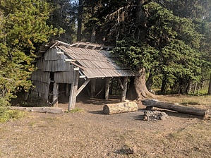
From Pollalie Trailhead, the trail begins with a short steep climb to a ridge, passes a short spurt trail to an overlook and climbs gradually to the junction with Tamanawas Falls Tie Trail #650B (3,560’) (1.2 miles). From the junction the trail climbs very gradually for 0.8 mile to the junction with Lamberson Spur Trail #644 (3,760’). Make the left turn heading south onto #645 and descend 0.3 mile to the junction with Bluegrass Ridge Trail #647 (3,680’). The trail leaves the junction continuing south on the ridge for the next 4.1 miles to the north end of Elk Meadows and the junction with Elk Meadows-Bluegrass Tie #647B (5,120’). #647B is a 0.3 mile trail heading east to Bluegrass Ridge Trail #647. There are several trails on and around Elk Meadow. If this is an overnight trip, many fine campsites can be found in the trees surrounding the meadow. The trail continues south along the south end of Elk Meadows and after 0.6 mile the trail reaches the junction (5,280’) with Gnarl Ridge Trail #652 (heading northwest) and Bluegrass Ridge Trail #647 (heading southeast). Continue straight on #645 and descend several switchbacks to Newton Creek (4,600’). Cross Newton Creek and travel 0.6 mile to Clark Creek (4,560’). Cross Clark Creek and continue 0.1 mile to the trail’s end at the junction with Umbrella Falls Trail #667 and Sahalie Falls Trail #667C. Follow Sahalie Falls Trail #667C south for 0.4 mile to reach the Hood River Meadows Trailhead parking area at Forest Road 3545.

Check out the Official Route and Triplogs.

Leave No Trace and +Add a Triplog after your hike to support this local community.

2018-09-07 HAZ_Hikebot
  • FS PDF
    guide related
    FS PDF
  • FS PDF - 2
    guide related
    FS PDF - 2

One-Way Notice
This hike is listed as One-Way.

When hiking several trails on a single "hike", log it with a generic name that describes the hike. Then link the trails traveled, check out the example.
WARNING! Hiking and outdoor related sports can be dangerous. Be responsible and prepare for the trip. Study the area you are entering and plan accordingly. Dress for the current and unexpected weather changes. Take plenty of water. Never go alone. Make an itinerary with your plan(s), route(s), destination(s) and expected return time. Give your itinerary to trusted family and/or friends.

 Permit $$
no fees or permits reported

if incorrect tell us about it

Mount Hood Forest
more info


 Directions
or
or
 Road


To hike
From Portland, OR
travel 31 miles east of Sandy on US Hwy 26 to Oregon Hwy 35. Turn north onto Oregon Hwy 35 and travel 16.5 miles north to Polallie Trailhead, approximately 0.7 miles north of milepost 73, and turn left (west) into the pullout just south of Cooper Spur Road. East Fork Trail #650 leaves from the pullout. Follow this trail 0.1 mile to its junction with Elk Meadows Trail #645.

From Hood River, OR
travel 22.2 miles south on Oregon Hwy 35 to Polallie Trailhead, approximately 0.3 miles south of milepost 74, and turn right (west) into the pullout just south of Cooper Spur Road. Follow the directions above from the parking area to the trail.
page created by HAZ_Hikebot on Mar 09 2010 4:56 pm
 90+° 8am - 6pm kills
helpcorrectionissue

end of page marker